File:Succor Creek (Malheur County, Oregon scenic images) (malDA0051).jpg

Succor_Creek_(Malheur_County,_Oregon_scenic_images)_(malDA0051).jpg (488 × 324 pixels, file size: 42 KB, MIME type: image/jpeg)
Captions
Captions
| Description |
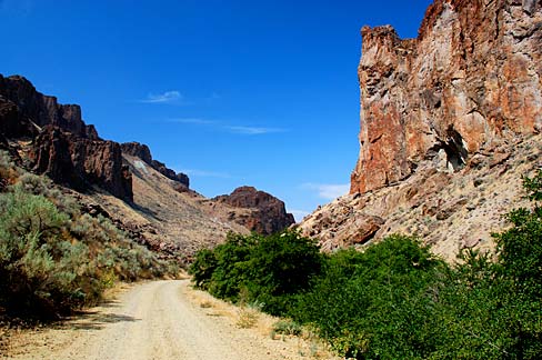
English: Rock formations in Succor Creek State Park. |
|||||
| Date | ||||||
| Source | ||||||
| Author |
English: Gary Halvorson, Oregon State Archives |
|||||
| Permission (Reusing this file) |
|
|||||
| Photo No. | malDA0051 | |||||
| Camera | Nikon D80 Digital SLR | |||||
| Lens | Nikon AF-S DX Zoom-Nikkor 18-135mm f/3.5-5.6G IF-ED | |||||
| Dimensions | 3810 x 2530 pixels (300 dpi version) Available for purchase from the Oregon State Archives. | |||||
| Keywords | English: horizontal, Oregon, Malheur County, Succor Creek, remote, rugged, rock formations, gravel road, blue sky, arid, desert, geology, erosion, natural history |

File history
Click on a date/time to view the file as it appeared at that time.
| Date/Time | Thumbnail | Dimensions | User | Comment | |
|---|---|---|---|---|---|
| current | 20:38, 15 April 2012 | | 488 × 324 (42 KB) | Smallbot (talk | contribs) | Commons:Bots/Requests/Smallbot 2: Uploading scenic images from Oregon State Archives |
You cannot overwrite this file.
File usage on Commons
The following page uses this file:
File usage on other wikis
The following other wikis use this file:
- Usage on ceb.wikipedia.org
- Usage on en.wikipedia.org
- Usage on www.wikidata.org
_(malDA0051).jpg&oldid=675601246)