File:Survey of Israel, Israel guide map 01 (FL155340665 3585533).jpg
Jump to navigation
Jump to search

Size of this preview: 416 × 600 pixels. Other resolutions: 166 × 240 pixels | 333 × 480 pixels | 532 × 768 pixels | 710 × 1,024 pixels | 1,420 × 2,048 pixels | 10,259 × 14,796 pixels.
Original file (10,259 × 14,796 pixels, file size: 170.46 MB, MIME type: image/jpeg)
Captions
Captions
Add a one-line explanation of what this file represents
Summary[edit]
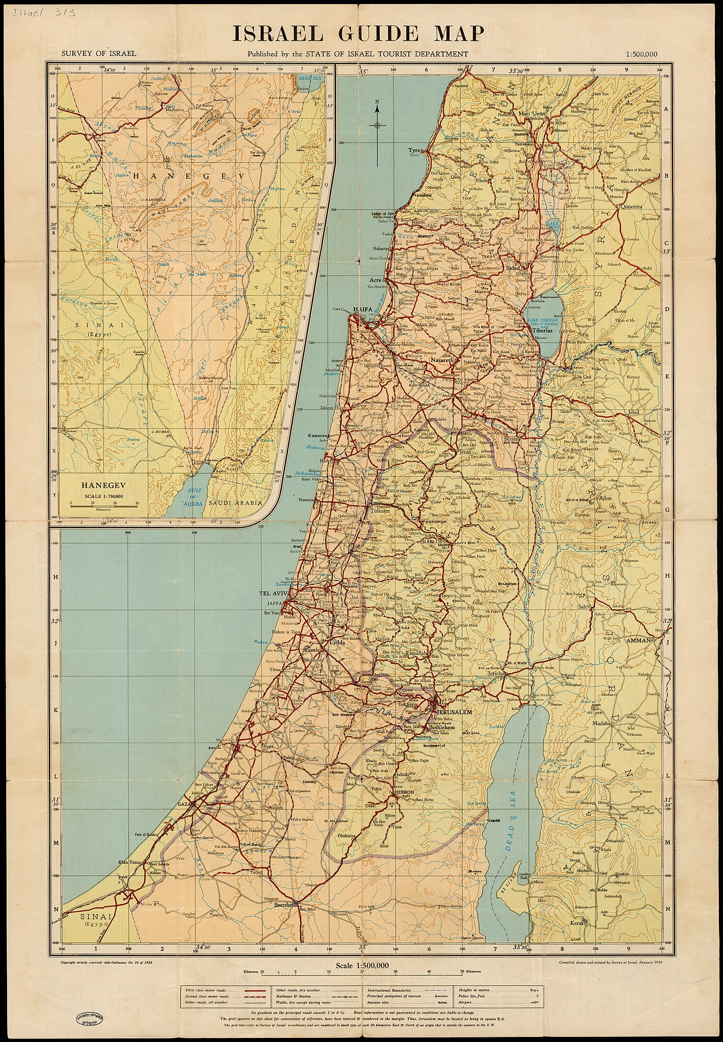
| Survey of Israel: Israel guide map
( |
||||||||||||||||||||||||
|---|---|---|---|---|---|---|---|---|---|---|---|---|---|---|---|---|---|---|---|---|---|---|---|---|
| Artist | ||||||||||||||||||||||||
| Title |
Israel guide map |
|||||||||||||||||||||||
| Publisher |
Survey of Israel |
|||||||||||||||||||||||
| Description |
Israel guide map. Compiled, drawn and printed by Survey of Israel. |
|||||||||||||||||||||||
| Language | English | |||||||||||||||||||||||
| Publication date | 1950 | |||||||||||||||||||||||
| Medium | 1 sheet : col ; | |||||||||||||||||||||||
| Dimensions | height: 62 cm (24.4 in); width: 43 cm (16.9 in) | |||||||||||||||||||||||
| Collection |
|
|||||||||||||||||||||||
| Current location |
|
|||||||||||||||||||||||
| Place of publication | Tel Aviv-Yafo | |||||||||||||||||||||||
| search Merhav catalog | Tel Aviv-Yafo | |||||||||||||||||||||||
| Notes | Inset map: Hanegev/; On verso text and lists: Tourist guide map of Israel. | |||||||||||||||||||||||
| scale | 1:500,000 cm | |||||||||||||||||||||||
| IE PID | IE155340663 | |||||||||||||||||||||||
| Rosetta filename | FL155340665 | |||||||||||||||||||||||
| NNL item ID (P3959) | 990035855330205171 | |||||||||||||||||||||||
| search Merhav catalog | English, Survey of Israel | |||||||||||||||||||||||
| search Merhav catalog | Survey of Israel | |||||||||||||||||||||||
| Source/Photographer |
|
|||||||||||||||||||||||
| Other versions | ||||||||||||||||||||||||
| Jpg / Tif version |
|
|||||||||||||||||||||||

.jpg)

.jpg&action=edit§ion=1)
Licensing[edit]
.jpg&action=edit§ion=2)
This work created by the United Kingdom Government is in the public domain.
This is because it is one of the following:
HMSO has declared that the expiry of Crown Copyrights applies worldwide (ref: HMSO Email Reply)
|
 |
This work was created or ordered by the State of Israel, and is in the public domain because it satisfies one of the conditions stipulated in Israel's copyright statute from 2007 (translation) regarding the State's copyrights:
|

|
File history
Click on a date/time to view the file as it appeared at that time.
| Date/Time | Thumbnail | Dimensions | User | Comment | |
|---|---|---|---|---|---|
| current | 01:02, 23 August 2023 | | 10,259 × 14,796 (170.46 MB) | Geagea (talk | contribs) | pattypan 22.03 |
You cannot overwrite this file.
File usage on Commons
The following page uses this file:
.jpg&oldid=795220230)