File:Title Page - Bridgeport Covered Bridge, Spanning South Fork of Yuba River at bypassed section of Pleasant Valley Road (originally Virginia Turnpike) in South Yuba HAER CAL,29-BRIGPO,1- (sheet 1 of 5).tif
Jump to navigation
Jump to search

Size of this JPG preview of this TIF file: 800 × 533 pixels. Other resolutions: 320 × 213 pixels | 640 × 427 pixels | 1,024 × 683 pixels | 1,280 × 853 pixels | 2,560 × 1,707 pixels | 14,401 × 9,601 pixels.
Original file (14,401 × 9,601 pixels, file size: 6.96 MB, MIME type: image/tiff)
Captions
Captions
Add a one-line explanation of what this file represents
Summary[edit]
| Warning | The original file is very high-resolution. It might not load properly or could cause your browser to freeze when opened at full size. |
|---|
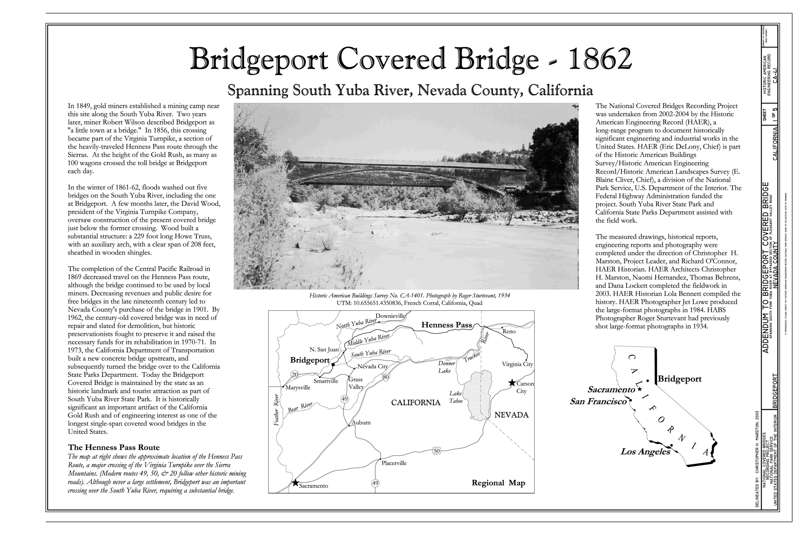
| Title Page - Bridgeport Covered Bridge, Spanning South Fork of Yuba River at bypassed section of Pleasant Valley Road (originally Virginia Turnpike) in South Yuba River State Park , Bridgeport, Nevada County, CA | ||||
|---|---|---|---|---|
| Photographer |
Marston, Christopher H., creator |
|||
| Title |
Title Page - Bridgeport Covered Bridge, Spanning South Fork of Yuba River at bypassed section of Pleasant Valley Road (originally Virginia Turnpike) in South Yuba River State Park , Bridgeport, Nevada County, CA |
|||
| Depicted place | California; Nevada County; Bridgeport | |||
| Date | 2003 | |||
| Current location |
Library of Congress Prints and Photographs Division Washington, D.C. 20540 USA http://hdl.loc.gov/loc.pnp/pp.print |
|||
| Accession number |
HAER CAL,29-BRIGPO,1- (sheet 1 of 5) |
|||
| Credit line |
|
|||
| Notes |
|
|||
| References |
Related names:
|
|||
| Source | https://www.loc.gov/pictures/item/ca1341.sheet.00001a | |||
| Permission (Reusing this file) |
|
|||
| Other versions |
.png) _in_South_Yuba_HAER_CAL,29-BRIGPO,1-_(sheet_1_of_5).png) |
|||

| Camera location | | View this and other nearby images on: OpenStreetMap |
|---|
File history
Click on a date/time to view the file as it appeared at that time.
| Date/Time | Thumbnail | Dimensions | User | Comment | |
|---|---|---|---|---|---|
| current | 21:45, 2 July 2014 |  | 14,401 × 9,601 (6.96 MB) | Fæ (talk | contribs) | GWToolset: Creating mediafile for Fæ. HABS batch upload 2 July 2014 (301:400) |
You cannot overwrite this file.
File usage on Commons
The following page uses this file: