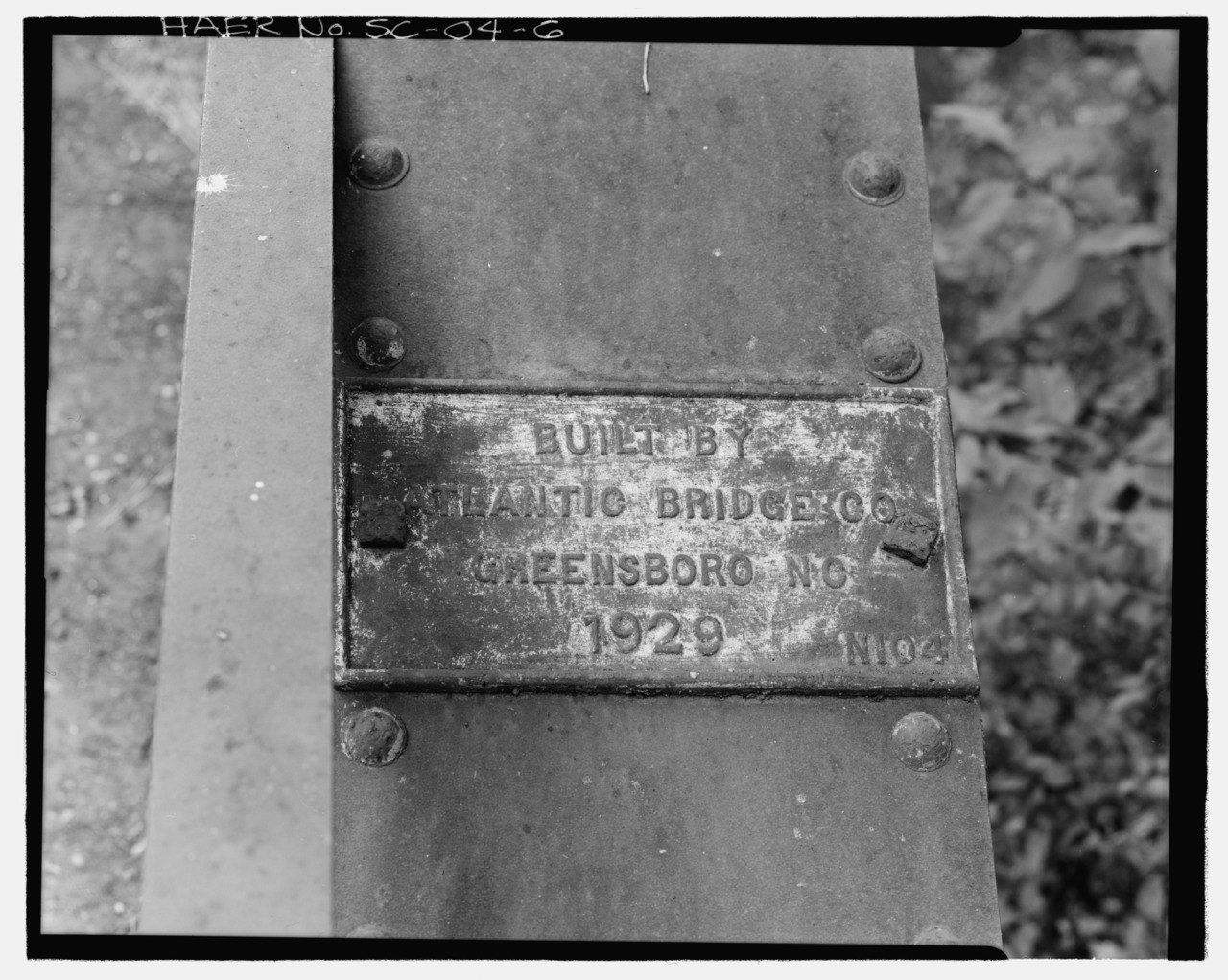
File:VIEW OF BRIDGE PLATE LOOKING NORTH - Road S-47 Bridge, Spanning Deep Creek on Road S-47, Ruby, Chesterfield County, SC HAER SC-04-6.tif
Jump to navigation
Jump to search

Size of this JPG preview of this TIF file: 751 × 599 pixels. Other resolutions: 301 × 240 pixels | 602 × 480 pixels | 962 × 768 pixels | 1,280 × 1,022 pixels | 2,560 × 2,043 pixels | 5,252 × 4,192 pixels.
Original file (5,252 × 4,192 pixels, file size: 21 MB, MIME type: image/tiff)
Captions
Captions
Add a one-line explanation of what this file represents
Summary[edit]
| VIEW OF BRIDGE PLATE LOOKING NORTH - Road S-47 Bridge, Spanning Deep Creek on Road S-47, Ruby, Chesterfield County, SC | ||||
|---|---|---|---|---|
| Photographer |
Barnes, Will, creator |
|||
| Title |
VIEW OF BRIDGE PLATE LOOKING NORTH - Road S-47 Bridge, Spanning Deep Creek on Road S-47, Ruby, Chesterfield County, SC |
|||
| Description |
South Carolina Department of Highways and Public Transportation; Atlantic Bridge Company; Calloway, Deborah, transmitter; South Carolina Department of Highways and Public Transportation, sponsor |
|||
| Depicted place | South Carolina; Chesterfield County; Ruby | |||
| Date | 1987 | |||
| Dimensions | 4 x 5 in. | |||
| Current location |
Library of Congress Prints and Photographs Division Washington, D.C. 20540 USA http://hdl.loc.gov/loc.pnp/pp.print |
|||
| Accession number |
HAER SC-04-6 |
|||
| Credit line |
|
|||
| Notes |
|
|||
| Source | https://www.loc.gov/pictures/item/sc1113.photos.203102p | |||
| Permission (Reusing this file) |
|
|||

File history
Click on a date/time to view the file as it appeared at that time.
| Date/Time | Thumbnail | Dimensions | User | Comment | |
|---|---|---|---|---|---|
| current | 21:10, 1 August 2014 |  | 5,252 × 4,192 (21 MB) | Fæ (talk | contribs) | GWToolset: Creating mediafile for Fæ. HABS 2014-08-01 (3201:3400) |
You cannot overwrite this file.
File usage on Commons
The following page uses this file: