File:Grâce-Hollogne Liège Belgium Map.png
Jump to navigation
Jump to search
No higher resolution available.
Grâce-Hollogne_Liège_Belgium_Map.png (290 × 220 pixels, file size: 5 KB, MIME type: image/png)
Captions
Captions
Add a one-line explanation of what this file represents
| Description |
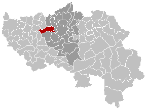
English: Map, municipality belgium Grâce-Hollogne
Français : Carte indiquant la localisation de la commune de Grâce-Hollogne dans la Province de Liège. |
|||
| Source | Own work | |||
| Author | LennartBolks | |||
| Permission (Reusing this file) |
PD | |||
| Other versions |
|


| This work has been released into the public domain by its author, LennartBolks. This applies worldwide. In some countries this may not be legally possible; if so: |
File history
Click on a date/time to view the file as it appeared at that time.
| Date/Time | Thumbnail | Dimensions | User | Comment | |
|---|---|---|---|---|---|
| current | 18:28, 6 September 2008 | | 290 × 220 (5 KB) | Ludger1961 (talk | contribs) | arrondissement sans Olne et sans Herve |
| 17:52, 6 September 2008 |  | 290 × 220 (5 KB) | Ludger1961 (talk | contribs) | arrondissement sans Olne | |
| 10:27, 5 March 2007 |  | 290 × 220 (7 KB) | Siebrand (talk | contribs) | Updated version by Westermarck | |
| 21:02, 4 April 2005 |  | 290 × 220 (5 KB) | Nicnac25~commonswiki (talk | contribs) | Map, municipality belgium Grâce-Hollogne {{PD}} FR; Carte indiquant la localisation de la commune de Grâce-Hollogne dans la Province de Liège. EN; Map from w:nl:Gebruiker:LennartBolks/kaartenhoekje in Public Domain by the Author choice. [[Categor |
You cannot overwrite this file.
File usage on Commons
The following page uses this file: