The Federal Republic of Nigeria is a country in West Africa and the most populous country on the African continent. Nigeria shares land borders with the Republic of ► Benin in the west, ► Chad and ► Cameroon in the east, ► Niger in the north, and borders the Gulf of Guinea with the islands of ► São Tomé and Príncipe and ► Equatorial Guinea in the south. Since 1991, its capital has been the centrally-located city of Abuja.
Nijeriya ƙasa ce a nahiyar Afrika. Tana da al'umma da ta kai fiye da mutum miliyan d'ari da ashirin da kabilun da suka haura 500. Hasali ma ita ce ƙasa ta uku a yawan kabilu a duniya.
Naigeria bu obodo di na west Afirika, o bukwa obodo nwere otutu mmadu karia obodo ndi ozo nile na mba Afirika. Naigeria na-obodo ► Benin republic gbara agbataobi na west Afirika, ya na ► Chad na ► Cameroon gbara agbataobi n'east Afirika, ya na ► Niger gbara agbataobi na north, werekwa rue na Gulf nke Guinea, nakwa islands nke São Tomé na Príncipe na ► Equatorial Guinea di na south. Kamgbe 1991, Isi obodo ya di n'Abuja.
Nàìjíríà jẹ́ ìkan nínú àwọn orílẹ̀-èdè ní Ilẹ̀ Adúláwọ̀. Nàìjíríà ni orílẹ̀-èdè kan ṣoṣo ti àwọn ènìyàn pọ̀ sí i jù ní Ilẹ̀ Adúláwọ̀. Nàìjíríà padà sí ìjọba òṣèlú ní ọdún 1999 lẹ́yìn ọdún mẹ́ẹ̀ẹ́dógún lábẹ́ ìjọba ti àwọn jagunjagun. Àwọn orílẹ̀-èdè Bẹ̀nẹ̀, Náíjà, Ṣáàdì, àti Kamẹrúùnù yí Nàìjíríà ká.
Short name
Nigeria
Official name
Federal Republic of Nigeria
Status
Independent country since 1960
Location
West Africa
Capital
Abuja
Population
140,431,790 inhabitants
Area
923,768 square kilometres (356,669 sq mi)
Major languages
English (official), Hausa, Igbo, Yoruba.
Major religions
Christianity (Protestantism, African Christianity, Roman Catholicism), Islam, traditional religions
This section holds a short summary of the history of the area of present-day Nigeria, illustrated with maps, including historical maps of former countries and empires that included present-day Nigeria.
The WIKIMEDIA COMMONS Atlas of the World is an organized and commented collection of geographical, political and historical maps available at Wikimedia Commons. The main page is therefore the portal to maps and cartography on Wikimedia. That page contains links to entries by country, continent and by topic as well as general notes and references.
Every entry has an introduction section in English. If other languages are native and/or official in an entity, introductions in other languages are added in separate sections. The text of the introduction(s) is based on the content of the Wikipedia encyclopedia. For sources of the introduction see therefore the Wikipedia entries linked to. The same goes for the texts in the history sections.
Historical maps are included in the continent, country and dependency entries.
The status of various entities is disputed. See the content for the entities concerned.
The maps of former countries that are more or less continued by a present-day country or had a territory included in only one or two countries are included in the atlas of the present-day country. For example the Ottoman Empire can be found in the Atlas of Turkey.


.jpg)


 Abia
Abia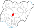 Abuja
Abuja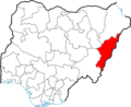 Adamawa
 Akwa Ibom
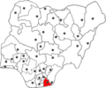 Akwa Ibom
 Anambra
 Anambra
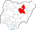 Bauchi
 Bayelsa
 Benue
Benue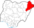 Borno
Borno Cross River
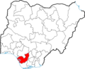 Delta
Delta Ebonyi
 Edo
Edo Ekiti
Ekiti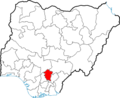 Enugu
Enugu Gombe
Gombe Imo
Imo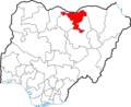 Jigawa
 Kaduna
 Kano
Kano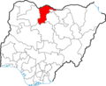 Katsina
 Kebbi
Kebbi Kogi
Kogi Kwara
Kwara Lagos
Lagos Nassarawa
 Niger
Niger Ogun
Ogun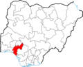 Ondo
Ondo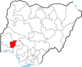 Osun
Osun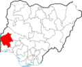 Oyo
Oyo Plateau
 Rivers
 Sokoto
 Taraba
 Yobe
Yobe Zamfara


