Category:Braunton
Jump to navigation
Jump to search
English: Braunton is situated west of Barnstaple, Devon, England and is claimed to be the largest village in England, with a population in 2001 of 7,510. It is home to the nearby Braunton Great Field and Braunton Burrows, a National Nature and UNESCO Biosphere Reserve.
Nederlands: Braunton is gelegen op 5 mijl westwaarts van Barnstaple in het district Noord-Devon en wordt het grootste dorp Engeland genoemd, met een bevolkingsaantal van 7510 in 2001. Op zijn grondgebied bevinden zich Braunton Great Field en Braunton Burrows, een natuurreservaat van wereldbetekenis.
Polski: Braunton - wieś w Wielkiej Brytanii, w Anglii w hrabstwie Devon, położona nad Kanałem Bristolskim przy ujściu rzeki Taw niedaleko Barnstaple.
Português: Braunton é um vilarejo localizado cinco milhas à oeste de Barnstaple, em Devon, Inglaterra. É aclamado como sendo o maior vilarejo da Inglaterra, com uma população de 7.510 habitantes (censo de 2001).
village and civil parish in Devon, UK ,_St_Brannock%27s_Church_--_2013_--_1557.jpg) | |||||
| Upload media | |||||
| Instance of | |||||
|---|---|---|---|---|---|
| Location | North Devon, Devon, South West England, England | ||||
| Said to be the same as | Braunton (Wikimedia duplicated page, civil parish) | ||||
 | |||||
Subcategories
This category has the following 20 subcategories, out of 20 total.
*
- Quality images of Braunton (13 F)
- Valued images of Braunton (7 F)
+
- Boode (8 F)
- Knowle (Braunton) (12 F)
A
- Ash, Braunton (10 F)
B
- St Brannoc's Well and Church (1 F)
- Braunton Memorial Garden (2 F)
- Buckland Manor, Braunton (2 F)
- Buckland, Braunton (9 F)
C
- Crow Point Light (2 F)
I
- Incledon (5 F)
M
- Mariners Arms, Braunton (2 F)
- Museum of British Surfing (3 F)
W
- The White Lion, Braunton (2 F)
- Winsham, Devon (2 F)
Media in category "Braunton"
The following 200 files are in this category, out of 1,354 total.
(previous page) (next page)-
 "Wysiwyg" - geograph.org.uk - 6041849.jpg 1,024 × 678; 463 KB
-
 "Wysiwyg" - geograph.org.uk - 6041850.jpg 1,024 × 678; 459 KB
-
 'Hippy' shack beside the SW coast path - geograph.org.uk - 6127635.jpg 1,024 × 768; 326 KB
-
 A 300 year old gate post near Fullabrook Farm - geograph.org.uk - 1670502.jpg 2,052 × 2,736; 1.75 MB
-

-
 A bend in the river - geograph.org.uk - 3297414.jpg 1,024 × 768; 129 KB
-

-

-

-
 A bridge on the River Caen in Blackwell wood - geograph.org.uk - 2064172.jpg 1,024 × 680; 245 KB
-

-
 A bridge over Knowl Water at Whitehall Mill - geograph.org.uk - 2271609.jpg 1,024 × 680; 244 KB
-
 A bridge over Knowl Water at Whitehall Mill - geograph.org.uk - 2271615.jpg 1,024 × 683; 242 KB
-
 A bridge over Knowl Water near Pippacott - geograph.org.uk - 2261997.jpg 1,024 × 680; 215 KB
-

-

-

-
-

-

-
 A bridge over the river Caen in Blackwell Wood - geograph.org.uk - 2063773.jpg 680 × 1,024; 271 KB
-
 A bridge over the River Caen in Blackwell Wood - geograph.org.uk - 2063839.jpg 680 × 1,024; 288 KB
-

-
 A bridge over the river Caen on Aylescott Hill - geograph.org.uk - 2176428.jpg 1,024 × 680; 328 KB
-

-

-
 A bridge over the river Caen on Vellator Way - geograph.org.uk - 2201643.jpg 1,024 × 680; 193 KB
-
 A bridge over the river Caen on Vellator Way - geograph.org.uk - 2201657.jpg 1,024 × 680; 177 KB
-

-

-

-

-

-
-

-

-
-

-
 A choice of routes through the dunes of Braunton Burrows - geograph.org.uk - 4721166.jpg 1,600 × 1,200; 1.61 MB
-

-

-

-

-
 A cross roads on Beara Down - geograph.org.uk - 1670497.jpg 640 × 480; 60 KB
-
 A disused building on Braunton Marsh - geograph.org.uk - 2201601.jpg 1,024 × 680; 131 KB
-
 A door in a wall on the Georgeham road - geograph.org.uk - 1919968.jpg 1,024 × 768; 316 KB
-

-
 A faded plaque on Caen bridge - geograph.org.uk - 2202838.jpg 1,024 × 769; 243 KB
-

-
 A field near Winsham Cross - geograph.org.uk - 1654241.jpg 640 × 480; 65 KB
-

-

-
-
 A footbridge over Knowl Water - geograph.org.uk - 2262305.jpg 1,024 × 680; 272 KB
-

-

-

-

-

-
 A footpath from Lower Winsham to Hawcombe Lane - geograph.org.uk - 2107690.jpg 1,024 × 680; 288 KB
-
 A footpath leaving Hawcombe Lane - geograph.org.uk - 2107731.jpg 1,024 × 680; 279 KB
-
 A footpath off from the Old Barnstaple Road - geograph.org.uk - 2265218.jpg 1,024 × 680; 285 KB
-

-
 A footpath to Upcott - geograph.org.uk - 2064657.jpg 1,024 × 680; 275 KB
-

-

-
 A footpath which leads from Upcott to Knowle - geograph.org.uk - 1921443.jpg 1,024 × 768; 348 KB
-

-

-

-

-

-

-
 A fork in the footpath in Blackwell Woods - geograph.org.uk - 2064530.jpg 1,024 × 680; 313 KB
-
 A gate in a field near Upcott - geograph.org.uk - 2064668.jpg 1,024 × 680; 232 KB
-

-
 A gate leading to Hannaburrow Lane - geograph.org.uk - 2126622.jpg 1,024 × 680; 310 KB
-
 A gate on a footpath on Saunton Down - geograph.org.uk - 2042829.jpg 1,024 × 680; 216 KB
-
 A gate on the footpath on Saunton Down - geograph.org.uk - 2042867.jpg 1,024 × 680; 164 KB
-
 A glimpse of Upcott down Nethercott Road - geograph.org.uk - 1921434.jpg 1,024 × 768; 178 KB
-
-
 A lane near Heddon Mills which leads to a ford - geograph.org.uk - 2082947.jpg 1,024 × 680; 278 KB
-
 A large chunk of concrete on Broad Sands beach - geograph.org.uk - 4721052.jpg 1,600 × 1,200; 1.69 MB
-
 A line of trees in a field near Upcott - geograph.org.uk - 2064682.jpg 1,024 × 683; 271 KB
-
 A man made lake beside the river Caen - geograph.org.uk - 2082952.jpg 1,024 × 683; 217 KB
-
 A moorhen on a snowbound Braunton Marsh - geograph.org.uk - 2201611.jpg 1,024 × 680; 159 KB
-
 A path which runs alongside the River Caen - geograph.org.uk - 2064518.jpg 1,024 × 680; 285 KB
-

-

-
 A property on the A361 near Heddon Mills - geograph.org.uk - 2001691.jpg 1,024 × 680; 216 KB
-
 A public footpath on a private road - geograph.org.uk - 2197446.jpg 1,024 × 684; 241 KB
-
-

-
 A reminder of Braunton's railway - geograph.org.uk - 42697.jpg 640 × 427; 116 KB
-
 A road junction called No Man's Land - geograph.org.uk - 1920237.jpg 1,024 × 768; 189 KB
-

-
 A road which serves East ^ West Saunton Farms - geograph.org.uk - 4004538.jpg 6,000 × 4,000; 4.76 MB
-
 A Shippen or cattle shed converted into holiday cottages - geograph.org.uk - 4004420.jpg 6,000 × 4,000; 5.62 MB
-
 A Shippen or cattle shed converted into holiday cottages - geograph.org.uk - 4004435.jpg 6,000 × 4,000; 4.46 MB
-
 A slipway on the river Caen near Velator - geograph.org.uk - 2201531.jpg 1,024 × 680; 156 KB
-
 A stile at the bottom of West Down Hill - geograph.org.uk - 2082317.jpg 1,024 × 680; 355 KB
-

-
 A stile near Knills Farm - geograph.org.uk - 2126321.jpg 1,024 × 680; 217 KB
-
 A stile near Winsham Down House - geograph.org.uk - 2082325.jpg 680 × 1,024; 189 KB
-
 A stile on the edge of Blackwell Wood - geograph.org.uk - 2064551.jpg 1,024 × 680; 303 KB
-
-

-
-

-
 A tower crane on Chesil Cliffs near Saunton Down - geograph.org.uk - 5214967.jpg 4,404 × 2,406; 4.59 MB
-

-

-
 A track which leads to North Lobb - geograph.org.uk - 1931681.jpg 768 × 1,024; 246 KB
-
-
 A valley through which runs Knowl Water - geograph.org.uk - 2265222.jpg 1,024 × 683; 198 KB
-
 A view across east Braunton towards the Artavia TV mast - geograph.org.uk - 4899246.jpg 3,409 × 1,654; 2.83 MB
-
 A view across the river Taw Mid Day, Christmas day, 2013 - geograph.org.uk - 3789389.jpg 3,566 × 1,640; 4.02 MB
-
 A view from Pind Lane towards Hawcombe Lane - geograph.org.uk - 2107799.jpg 1,024 × 680; 173 KB
-

-
 A view to Lundy - geograph.org.uk - 1342359.jpg 483 × 640; 85 KB
-
-

-
 A waterway on Braunton Marsh - geograph.org.uk - 1174792.jpg 480 × 640; 65 KB
-

-
 A £540,000 scheme to reduce flood risk in Braunton - geograph.org.uk - 5277994.jpg 6,000 × 4,000; 4.39 MB
-

-
 A361 in Corhill Head Copse - geograph.org.uk - 3442042.jpg 1,024 × 768; 211 KB
-
 Abandoned boat at Velator Quay - geograph.org.uk - 1358614.jpg 640 × 480; 106 KB
-
 Access to the beach at Crow Beach House - geograph.org.uk - 4117003.jpg 2,560 × 1,920; 2.03 MB
-

-
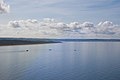
 Across Barnstaple Bay - geograph.org.uk - 1342354.jpg 640 × 463; 72 KB
-

-

-
 Agricultural Inn, Braunton - geograph.org.uk - 3031574.jpg 2,000 × 1,493; 275 KB
-
 Agricultural Inn, Braunton - geograph.org.uk - 3442076.jpg 1,024 × 512; 92 KB
-
 Airy Point - geograph.org.uk - 6041852.jpg 1,024 × 678; 322 KB
-
 Airy Point - geograph.org.uk - 6041854.jpg 1,024 × 678; 404 KB
-
 Amenities at Saunton Sands - geograph.org.uk - 5317737.jpg 1,600 × 1,200; 790 KB
-

-

-
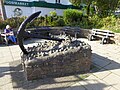 Anchor memorial, Caen Street, Braunton - geograph.org.uk - 4722887.jpg 1,600 × 1,200; 1.69 MB
-
 Another photograph of the Saunton Sands Hotel - geograph.org.uk - 5214487.jpg 6,000 × 4,000; 5.62 MB
-

-
 Approaching Ash Barton Manor from the south - geograph.org.uk - 6129457.jpg 1,024 × 768; 300 KB
-
 Approaching Fullabrook Wind Farm - geograph.org.uk - 2748054.jpg 4,320 × 3,240; 2.82 MB
-

-
 Approaching Nethercott from Upcott - geograph.org.uk - 1921488.jpg 1,024 × 768; 307 KB
-
 Approaching North Lobb - geograph.org.uk - 1931682.jpg 1,024 × 768; 269 KB
-
 Approaching Upcott on the Nethercott Road - geograph.org.uk - 1921447.jpg 1,024 × 768; 265 KB
-
 Approaching Velator Bridge heading towards Braunton Marsh - geograph.org.uk - 6195258.jpg 5,472 × 3,648; 4.63 MB
-
 Arable land at Park Farm - geograph.org.uk - 5952236.jpg 1,024 × 804; 238 KB
-
 Arable land, south of Old Barnstaple Road - geograph.org.uk - 5952229.jpg 1,024 × 768; 258 KB
-
 Arlington Terrace, Braunton - geograph.org.uk - 4720587.jpg 1,600 × 1,200; 1.42 MB
-
 Ash Barton Manor, from the west - geograph.org.uk - 6128388.jpg 1,024 × 751; 194 KB
-
 Ash Road - geograph.org.uk - 2746179.jpg 4,320 × 3,240; 7.74 MB
-
 Ash Road approaching Braunton - geograph.org.uk - 1240971.jpg 480 × 640; 95 KB
-
 Ash road heading towards Ash Barton. - geograph.org.uk - 828456.jpg 640 × 480; 78 KB
-
 Ash Road looking east - geograph.org.uk - 2746134.jpg 3,240 × 2,430; 1.26 MB
-
 Ash Road looking west - geograph.org.uk - 2746141.jpg 3,672 × 2,754; 1.57 MB
-
 At your convenience - geograph.org.uk - 1399147.jpg 640 × 480; 102 KB
-

-
 Autumn Woodland - geograph.org.uk - 67152.jpg 640 × 480; 148 KB
-
 B3231 towards Braunton - geograph.org.uk - 522552.jpg 640 × 425; 65 KB
-
 Bales on Braunton Great Field - geograph.org.uk - 4722825.jpg 1,600 × 1,200; 1.43 MB
-
 Barn at Ash Barton - geograph.org.uk - 6128718.jpg 1,024 × 738; 185 KB
-
 Barn at Marsh Side - geograph.org.uk - 4722741.jpg 1,600 × 1,200; 1.65 MB
-
 Barnstaple Bay - geograph.org.uk - 42694.jpg 640 × 427; 38 KB
-
 Basket case, Braunton - geograph.org.uk - 1324131.jpg 640 × 468; 100 KB
-
 Bathers in the dunes, Saunton Sands - geograph.org.uk - 5944171.jpg 800 × 533; 84 KB
-
 Be Aware Pedestrians^ - geograph.org.uk - 1366709.jpg 640 × 480; 68 KB
-
 Beach and dunes, Saunton - geograph.org.uk - 4682590.jpg 1,024 × 768; 124 KB
-
 Beach and foreshore at Broad Sands - geograph.org.uk - 4720933.jpg 1,600 × 1,200; 1.62 MB
-
 Beach huts, Saunton Sands - geograph.org.uk - 3856972.jpg 900 × 444; 135 KB
-
 Beach near Airy Point - geograph.org.uk - 6041851.jpg 678 × 1,024; 462 KB
-
 Beach near Crow Point - geograph.org.uk - 6041772.jpg 1,024 × 678; 583 KB
-
 Beach near Crow Point - geograph.org.uk - 6041784.jpg 1,024 × 678; 435 KB
-
 Beach near Crow Point - geograph.org.uk - 6041789.jpg 1,024 × 678; 584 KB
-
 Beach near Crow Point - geograph.org.uk - 6041794.jpg 1,024 × 678; 701 KB
-
 Beach near Crow Point - geograph.org.uk - 6041799.jpg 678 × 1,024; 512 KB
-
 Beach near Crow Point - geograph.org.uk - 6041807.jpg 1,024 × 678; 730 KB
-
 Beach near Crow Point - geograph.org.uk - 6041840.jpg 1,024 × 678; 678 KB
-
 Beara Down - geograph.org.uk - 2701532.jpg 640 × 480; 62 KB
-
 Beara Farm and surrounding houses - geograph.org.uk - 4828935.jpg 6,000 × 4,000; 4.72 MB
-
 Beware of other road users... Braunton Marsh - geograph.org.uk - 4117018.jpg 2,560 × 1,920; 1.99 MB
-
 Black Horse, Braunton - geograph.org.uk - 5838190.jpg 1,024 × 828; 154 KB
-
 Bloomfield House - geograph.org.uk - 963302.jpg 640 × 480; 71 KB
-
 Boardwalk on Braunton Burrows - geograph.org.uk - 4686193.jpg 1,024 × 802; 275 KB
-
 Boardwalk through the dunes at the south of Braunton Burrows - geograph.org.uk - 4721069.jpg 1,200 × 1,600; 1.91 MB
-
 Boardwalk through the sand dunes - geograph.org.uk - 4721162.jpg 1,600 × 1,200; 1.65 MB
-
 Boat on banks of the River Caen - geograph.org.uk - 1354670.jpg 640 × 480; 129 KB
-
 Boats by River Caen, south of Velator - geograph.org.uk - 4720613.jpg 1,600 × 1,200; 1.63 MB
-
 Boats on the banks of the River Caen - geograph.org.uk - 1354638.jpg 480 × 640; 69 KB
-
 Boode House - geograph.org.uk - 5838208.jpg 1,024 × 809; 228 KB
-
 Boode Road - geograph.org.uk - 5838214.jpg 1,024 × 759; 224 KB
-
 Bossmans Corner, Braunton - geograph.org.uk - 4722875.jpg 1,600 × 1,200; 1.22 MB
-
 Boundary and stile, Braunton Burrows - geograph.org.uk - 6128370.jpg 1,024 × 755; 203 KB
-
 Boundary Drain - geograph.org.uk - 5386167.jpg 1,024 × 739; 235 KB
-
 Boundary Drain - geograph.org.uk - 5386204.jpg 1,024 × 768; 215 KB
-
 Bowen Court - South Street - geograph.org.uk - 5393234.jpg 640 × 480; 76 KB
-
 Branch Farm, Pippacott - geograph.org.uk - 5310844.jpg 6,000 × 4,000; 5.44 MB


.jpg)


