File:Lido de Thau, Sète cf04BW.jpg
Jump to navigation
Jump to search
Size of this preview: 800 × 500 pixels. Other resolutions: 320 × 200 pixels | 640 × 400 pixels | 1,024 × 640 pixels | 1,280 × 800 pixels | 2,560 × 1,600 pixels | 7,038 × 4,399 pixels.
Original file (7,038 × 4,399 pixels, file size: 16.92 MB, MIME type: image/jpeg)
Captions
Captions
Add a one-line explanation of what this file represents
Summary[edit]
| Camera location | | View this and other nearby images on: OpenStreetMap |
|---|
| Description |
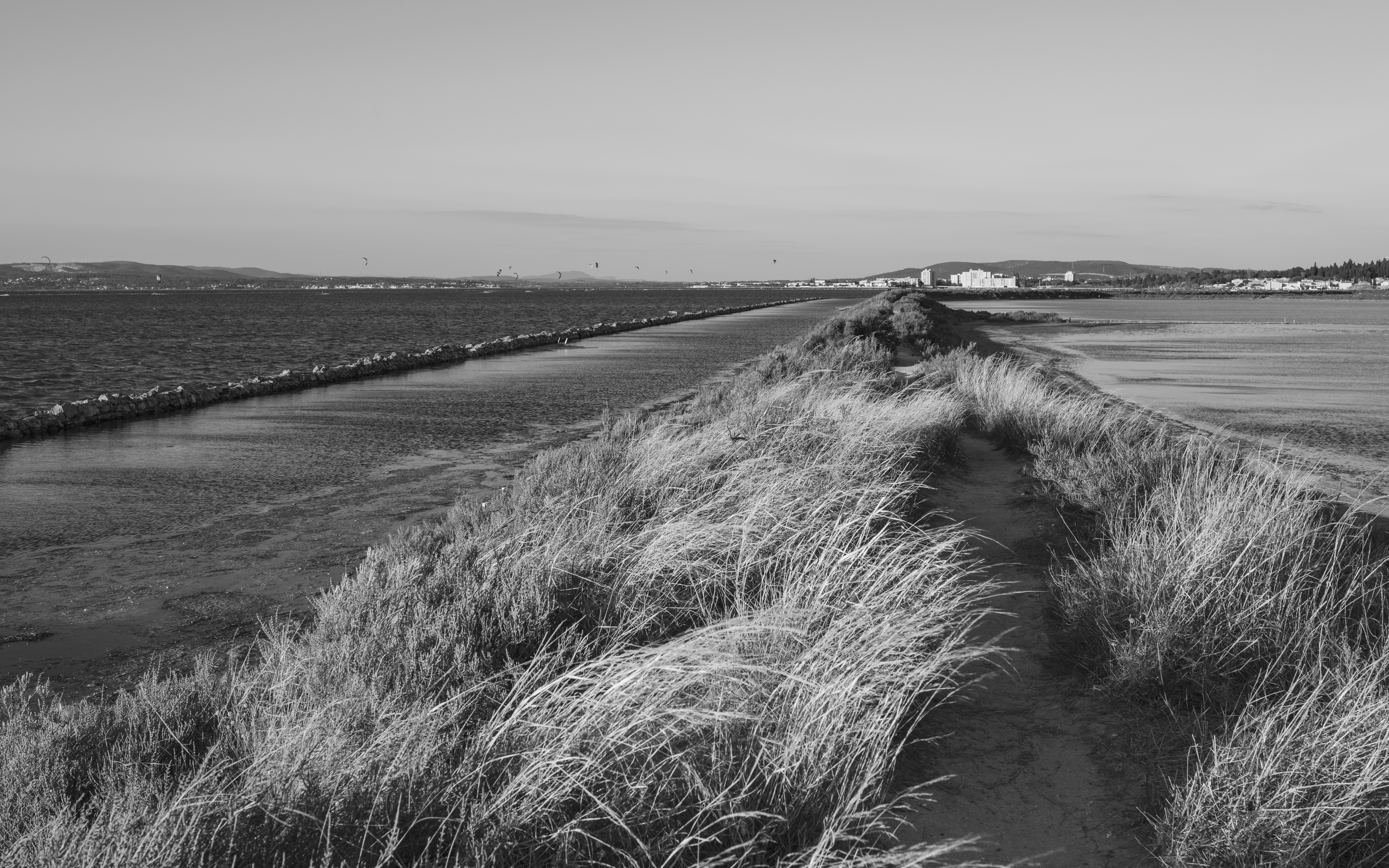
English: The Étang de Thau on the left and former salt evaporation ponds on the right, in the "Lido de Thau", an area protected by the Conservatoire du littoral. Sète, Hérault, France. |
| Date | Taken on 8 October 2016, 18:26:31 |
| Source | Own work |
| Author | Christian Ferrer |
| Permission (Reusing this file) |
I, the copyright holder of this work, hereby publish it under the following license: This file is licensed under the Creative Commons Attribution 4.0 International license.
|
| Other versions |
|

File history
Click on a date/time to view the file as it appeared at that time.
| Date/Time | Thumbnail | Dimensions | User | Comment | |
|---|---|---|---|---|---|
| current | 10:56, 31 December 2016 | | 7,038 × 4,399 (16.92 MB) | Christian Ferrer (talk | contribs) | =={{int:filedesc}}== <table cellpadding="4" class="toccolours vevent" style="width:100%;direction:{{Dir|{{int:Lang}}}}"> <tr><td colspan="2" style="vertical-align:top;background:#E3E3E3;text-align:center;font-size:1.6em;font-weight:bold"> [[:Category:L... |
You cannot overwrite this file.
File usage on Commons
The following 3 pages use this file: