Category:Maps of Prussia
(Redirected from Atlas of Prussia)
- Maps are also available as part of the
 Wikimedia Atlas of the World project in the Atlas of Prussia.
Use the appropriate category for maps showing all or a large part of Germany. See subcategories for smaller areas:
| If the map shows | Category to use |
|---|---|
| Germany on a recently created map | Category:Maps of Germany or its subcategories |
| Germany on a map created more than 70 years ago | Category:Old maps of Germany or its subcategories |
| the history of Germany on a recently created map | Category:Maps of the history of Germany or its subcategories |
| the history of Germany on a map created more than 70 years ago | Category:Old maps of the history of Germany or its subcategories |
Wikimedia category | |||||
| Upload media | |||||
| Instance of | |||||
|---|---|---|---|---|---|
| Category combines topics | |||||
| Prussia | |||||
historic German state in central Europe, 1525–1947 | |||||
| Instance of |
| ||||
| Location |
| ||||
| Capital |
| ||||
| Basic form of government | |||||
| Official language | |||||
| Anthem |
| ||||
| Inception |
| ||||
| Dissolved, abolished or demolished date |
| ||||
| Population |
| ||||
| Area |
| ||||
| Religion or worldview | |||||
| Replaced by |
| ||||
| Different from | |||||
| |||||
Subcategories
This category has the following 21 subcategories, out of 21 total.
B
D
- Maps of the Duchy of Prussia (34 F)
E
F
- Flag maps of Prussia (10 F)
K
M
- Maps of Old Prussians (17 F)
- Maps of the County of Mark (27 F)
O
P
R
- Rail transport maps of Prussia (29 F)
S
T
W
Media in category "Maps of Prussia"
The following 79 files are in this category, out of 79 total.
-
1914-Der I. Armee-Korps-Bezirk-04.png 1,692 × 1,824; 231 KB
-
1914-Der I.AK-Bezirk-01.png 1,692 × 1,824; 232 KB
-
1914-Der I.AK-Bezirk-02.png 1,692 × 1,824; 215 KB
-
1914-Der I.AK-Bezirk-03.png 1,692 × 1,824; 231 KB
-
1914-Der I.AK-Bezirk.png 1,692 × 1,824; 201 KB
-
1914-Deutsches Reich-Frankreich-AK-Bezirke.png 786 × 836; 118 KB
-
1914-Die aktiven deutschen Armeekorps.png 933 × 743; 193 KB
-
1914-Lage I.AK im Deutschen Reich.png 735 × 610; 95 KB
-
1914-Lage IV.AK im Deutschen Reich.png 1,084 × 907; 153 KB
-
1914-Standortkarte IV.Armeekorps-verkürzt.png 1,600 × 1,881; 331 KB
-
A map of Saxony and Prussia in 1789.jpg 781 × 565; 49 KB
-
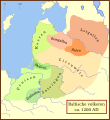
Balten 1200.svg 1,003 × 1,096; 338 KB
-
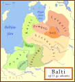
Balti ap 13.gs.svg 1,003 × 1,096; 530 KB
-
Baltic Tribes c 1200 es.svg 988 × 1,088; 650 KB
-
Baltic Tribes c 1200 pt.svg 988 × 1,088; 278 KB
-
Baltic Tribes c 1200-hu.svg 768 × 850; 382 KB
-
Baltic Tribes c 1200-uk.svg 988 × 1,088; 375 KB
-
Baltic Tribes ca 1200 AD (et).svg 988 × 1,088; 687 KB
-
Balticstribesinarabic.png 800 × 874; 144 KB
-
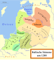
Baltische Stämme um 1200.png 1,980 × 2,180; 473 KB
-
Baltische Stämme um 1200.svg 988 × 1,088; 447 KB
-
Baltiskai gintu.png 2,000 × 2,185; 587 KB
-
Baltų gentys 12-as amžius.svg 1,003 × 1,096; 650 KB
-
Baltų gentys XII amžiuje.svg 1,003 × 1,096; 642 KB
-
Braunschweig 1932-1945.png 5,155 × 4,000; 2.47 MB
-
Etnoregionai.JPG 411 × 332; 21 KB
-
Gdansk Bay Borderlines 1939 blank.png 1,858 × 1,202; 29 KB
-
Gdansk Bay Borderlines 1939 English-colour.jpg 1,024 × 662; 172 KB
-
Gdansk Bay Borderlines 1939 English.png 1,858 × 1,202; 35 KB
-
Gdansk Bay Borderlines 1939 English.svg 1,339 × 866; 49 KB
-
Gdansk Bay Borderlines 1939 Esperanto.svg 1,339 × 866; 161 KB
-
Gdansk Bay Borderlines 1939 German.png 1,858 × 1,202; 35 KB
-
Gdansk Bay Borderlines 1939 greek.png 1,339 × 866; 93 KB
-
Gdansk Bay Borderlines 1939 Polish.png 1,858 × 1,202; 36 KB
-
Gdansk Bay Borderlines 1939 Welsh.svg 1,339 × 866; 34 KB
-
Gdansk Bay Borderlines 1939-hu.svg 1,339 × 866; 32 KB
-
Gdansk Bay Details 1939 english.PNG 1,668 × 1,200; 70 KB
-
Gdansk Bay Details 1939 german.png 1,668 × 1,200; 39 KB
-
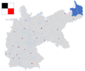
Germany former prussian lander.png 444 × 599; 18 KB
-
Herzogtum Magdeburg over LSA 2007.png 787 × 1,012; 68 KB
-
Kurzemes un Zemgales hercogiste 1740 locator.svg 984 × 738; 183 KB
-
Kurzemes un Zemgales Hercogiste 1740.svg 1,074 × 945; 498 KB
-
Mapa radziwiłłowska 1613 Olsztyn Warmia.jpg 1,054 × 871; 437 KB
-
NL+Luettich1789.png 533 × 459; 142 KB
-
Polska 960 - 992-es.svg 11,510 × 11,360; 2.5 MB
-
Polska 960 - 992.png 1,854 × 1,828; 1.45 MB
-
Polska 960 - 992.svg 11,510 × 11,360; 2.37 MB
-
Południowa Warmia w XIII wieku.png 2,118 × 1,114; 586 KB
-
Prov.-Nassau.png 531 × 712; 147 KB
-
Pruse Autriche XVIIIème siècle.jpg 776 × 432; 158 KB
-
Prusse Autriche XVIII.jpg 540 × 432; 107 KB
-
Prussia corresponding to present German states.png 5,825 × 6,465; 1.68 MB
-
Prussian clans 13th century.svg 1,790 × 1,260; 214 KB
-
Prusy en 21 century.png 2,252 × 1,590; 409 KB
-
Prusy historyczne.png 613 × 459; 51 KB
-
Prusy wschodnie 1939.png 2,014 × 2,511; 1.62 MB
-
Prusy zachodnie 1939.png 2,014 × 2,511; 1.65 MB
-
Prūsija 1795m.png 811 × 603; 35 KB
-
Prūsijos žemėlapis.svg 512 × 288; 552 KB
-
Prūsų valdomos žemės.png 1,920 × 1,080; 1.08 MB
-
Prūsų žemės.png 759 × 540; 315 KB
-
Entwicklung̠Westpreussen.png 6,574 × 3,924; 574 KB
-
7yearswar-es.svg 1,410 × 1,120; 1.2 MB
-
7yearswar.PNG 1,996 × 1,563; 908 KB
-
Tannenberg 1410.png 1,200 × 1,424; 855 KB
-
Teutonic Order 1260-es.svg 1,210 × 1,053; 1.74 MB
-
Teutonic Order 1410-es.svg 1,210 × 1,053; 1.69 MB
-
II Powstanie Pruskie.svg 383 × 325; 548 KB
-
Mappa dello Stato dei Cavalieri Teutonici 1410.jpg 1,654 × 1,449; 1.65 MB
-
Ordensburgen Ausschnitt.jpg 1,424 × 1,050; 254 KB
-
Ordine Teutonico 1260.png 5,001 × 4,346; 1.73 MB
-
Orientierungskarte zu der Eroberung Preussens durch die Deutschen.jpg 2,804 × 2,225; 1.66 MB
-
Ursprung der Farben des Deutschen Reichs.png 3,000 × 3,000; 1.22 MB
-
Alison's history of Europe atlas 1850 (92102638).jpg 7,126 × 5,784; 4.62 MB
-
Земля и вода вокруг Каупа эпохи викингов.jpg 1,068 × 1,040; 240 KB
-
מפת התרחבות פרוסיה 1701 - 1871.png 1,800 × 1,444; 626 KB

