Category:Atlas van Loon
(Redirected from Atlas van Loon)
English: Maps and pictures from the Atlas van Loon.
Nederlands: Kaarten en afbeeldingen afkomstig uit de Atlas van Loon.
book | |||||
| Upload media | |||||
| Instance of |
| ||||
|---|---|---|---|---|---|
| |||||
Source
[edit]Subcategories
This category has only the following subcategory.
Media in category "Atlas van Loon"
The following 168 files are in this category, out of 168 total.
-
Alkmaar - Alcmaria (Atlas van Loon).jpg 5,500 × 4,416; 4.47 MB
-
Americae nova Tabula - Map of North and South America (Willem Blaeu, 1665).jpg 5,500 × 4,104; 3.63 MB
-
Amersfoort - Amisfurtum (Atlas van Loon).jpg 5,500 × 4,578; 4.42 MB
-
América do Sul - Fragmento do Mapa do Mundo de Joan Blaeu (1664).jpg 1,356 × 1,292; 1.33 MB
-
Antwerp - Antverpia; Gallis Anvers, Vernacule Antwerpen (Atlas van Loon).jpg 5,500 × 4,373; 4.27 MB
-
Approche 1597.png 640 × 480; 653 KB
-
Arnemuiden - Arnemuyden (Atlas van Loon).jpg 5,500 × 4,512; 3.94 MB
-
Arnhem - Aernhem (Atlas van Loon).jpg 5,500 × 4,384; 4.11 MB
-
Arnhem schipbrug.jpg 525 × 385; 128 KB
-
Atlas van Loon Nova Zemla.jpg 3,040 × 2,335; 5.02 MB
-
Avenio vulgo Avignon (Atlas van Loon).jpg 5,500 × 4,334; 4.31 MB
-
Axel (Atlas van Loon).jpg 2,524 × 2,015; 3 MB
-
Begijnebolwerk Traiectum - Wttecht - Utrecht (Atlas van Loon).jpg 352 × 458; 149 KB
-
Beleg van Breda 1624 contra en circumvallatielinies.jpg 1,249 × 825; 206 KB
-
Beleg van Breda 1624 Legerkamp Ginneken.jpg 1,703 × 1,324; 429 KB
-
Beleg van Breda 1624 Legerkamp Hage.jpg 1,130 × 812; 152 KB
-
Beleg van Breda 1624 Legerkamp Terheijden.jpg 1,250 × 1,584; 370 KB
-
Beleg van Breda 1624 Legerkamp Teteringen.jpg 1,251 × 825; 177 KB
-
Belegering van Schenkenschans in 1635 en 1636 (Johannes Jacobus Schort).jpg 5,500 × 4,549; 4.1 MB
-
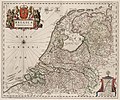
Belgica Foederata (1664).jpg 5,500 × 4,573; 3.78 MB
-
Bellingwolder Schans (Atlas van Loon).jpg 2,533 × 4,141; 3.63 MB
-
BlaeuGouda.jpg 5,500 × 4,299; 4.06 MB
-
Blokzijl - Blockzyl (Atlas van Loon).jpg 5,500 × 4,602; 3.26 MB
-
Bolsward - Bolswaert (Atlas van Loon).jpg 5,500 × 4,248; 3.47 MB
-
Bourtange - Bovrtang (Atlas van Loon).jpg 2,473 × 4,105; 3.79 MB
-
Breda (Atlas van Loon).jpg 5,500 × 4,470; 3.57 MB
-
Brefurtum Capta Anno 1597 - Capture of Bredevoort 1597 (J.Blaeu 1649).jpg 5,500 × 4,399; 3.28 MB
-
Brefurtum Capta Anno 1597 - Siege of Bredevoort (Detail, J.Blaeu 1649).jpg 2,872 × 4,151; 2.77 MB
-
Brielle - Briela - Den Briel - Brill (Atlas van Loon).jpg 5,500 × 4,334; 3.29 MB
-
Brielle 1649 Blaeu HR².JPG 5,500 × 4,334; 2.7 MB
-
Brugge (Atlas van Loon).jpg 5,500 × 4,266; 4.13 MB
-
BrugseVrije1664 (cropped).jpg 2,762 × 1,515; 1.42 MB
-
BrugseVrije1664.jpg 5,500 × 4,327; 3.61 MB
-
Cambrai - Cameracvm vulgo Cambray - Kamerijk (Atlas van Loon).jpg 5,500 × 4,405; 3.6 MB
-
Circus Maximus (Atlas van Loon).jpg 5,238 × 4,025; 8.06 MB
-
Coat of arms of Grand Illyria.png 264 × 294; 183 KB
-
Coeverden - Map of Coevorden (Atlas van Loon).jpg 5,500 × 4,352; 2.06 MB
-
Coevordia Obsessa et Capta - Siege of Coevorden in 1592.jpg 5,500 × 4,411; 2.88 MB
-
Colloseum - Amphitheatri Reliquiae (Atlas van Loon).jpg 5,500 × 4,174; 3.59 MB
-
Culemborg - Culenbvrgvm (Atlas van Loon).jpg 5,500 × 4,132; 4.14 MB
-
Damme - Dammvm (Atlas van Loon).jpg 5,500 × 4,474; 2.81 MB
-
Daventria vernacule Deventer - Map of Deventer (J.Blaeu).jpg 5,500 × 4,485; 3.87 MB
-
De schans Crèvecoeur (Atlas van Loon).jpg 3,520 × 2,307; 3.03 MB
-
Delfsiil - Delfzijl (Atlas van Loon).jpg 5,500 × 4,356; 3.05 MB
-
Delft - Delfi Batavorum vernacule Delft (1649).jpg 5,500 × 4,325; 4.29 MB
-
DenBoschBlaeu.jpg 5,500 × 4,485; 3.87 MB
-
Dendermonde - Teneramonda (Atlas van Loon).jpg 5,500 × 4,396; 3.98 MB
-
Drenthe - Drentia Comitatus - Transiselaniae Tabula II (Cornelio Pynacker, 1664).jpg 5,500 × 4,046; 3.2 MB
-
Enkhuizen - Topographia Enchusae (Cornelis Biens, 1649) - detail Eiland.jpg 1,055 × 842; 349 KB
-
Enkhuizen - Topographia Enchusae (Cornelis Biens, 1649).jpg 5,500 × 4,288; 4.21 MB
-
Fort Liefkenshoek - Liefkens Hoeck (Atlas van Loon).jpg 2,524 × 2,021; 1.6 MB
-
Fort Lillo (Atlas van Loon).jpg 3,020 × 1,877; 1.32 MB
-
Fort Mardijk - Fort-Mardyck and the attacks of 1646 (Atlas van Loon).jpg 5,500 × 4,544; 2.79 MB
-
Fort Nassau of De Voorn (Heerewaarden).jpg 3,296 × 2,601; 2.22 MB
-
Fort Rammekens of Zee-Burg.jpg 5,500 × 4,299; 2.99 MB
-
Fortification of Melazzo (1663).jpg 3,390 × 5,500; 2.18 MB
-
Frankfurt am Main - Novam Hanc Territorii Francofurtensis Tabulam (J.Blaeu, 1663).jpg 5,500 × 4,663; 3.98 MB
-
FransVlaanderen1664.jpg 3,083 × 2,391; 1.39 MB
-
Geldern - Gelre (1649).jpg 5,500 × 4,435; 4.03 MB
-
Geldria Ducatus, et Zutfania Comitatus (1664, Apud Guilj. Blaeuw).jpg 5,500 × 4,263; 3.53 MB
-
Gezicht op Geraardsbergen - View of Geraardsbergen (Atlas van Loon).jpg 5,500 × 3,929; 3.16 MB
-
Gezicht op Hof van Brussel - Cour de Brusselles - Koudenberg (Atlas van Loon).jpg 5,500 × 4,348; 3.55 MB
-
Ghent, Belgium ; Map 1649.jpg 5,500 × 4,450; 10.91 MB
-
Goes 1649 Blaeu'.jpg 5,500 × 4,310; 2.19 MB
-
Grave, the Netherlands (1649).jpg 5,500 × 4,417; 3.27 MB
-
Het fort van Griet-Zijl (Greetsiel) in Oost-Friesland (Atlas van Loon).jpg 3,319 × 4,497; 1.87 MB
-
Groeninga - Groningen (Atlas van Loon).jpg 5,500 × 4,388; 4.32 MB
-
Wapen van Groenlo (Zutphania Comitatus, 1664).jpg 263 × 344; 90 KB
-
Grolla - Map of Groenlo, after 1628 (J.Blaeu, 1649).jpg 5,500 × 4,211; 2.7 MB
-
Haga Comitis - Den Haag (Atlas van Loon).jpg 5,334 × 4,135; 7.95 MB
-
Harlemum - Haerlem - Haarlem (1646, Atlas van Loon).jpg 5,310 × 4,338; 9.26 MB
-
Heusden (1649).jpg 5,500 × 4,444; 3.61 MB
-
Hoorn - Blaeu 1649.jpg 5,500 × 4,421; 3.87 MB
-
Hugo-de-Groot-Grollæ-obsidio-cvm-annexis-anni-M-DC-XXVII MG 0154.tif 5,416 × 2,359; 36.59 MB
-
Hulst (Atlas van Loon).jpg 2,874 × 4,445; 1.5 MB
-
IJzendijke.jpg 4,646 × 3,047; 1.67 MB
-
ImperiiCaroliMagni.jpg 5,500 × 3,726; 2.44 MB
-
Jülich - Gulich (Atlas van Loon).jpg 3,940 × 3,051; 1.22 MB
-
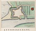
Kaart van de schans van Kuinre (Kuynder-schans).jpg 3,482 × 2,988; 1.26 MB
-
Kaart van Drenthe (1634), Cornelis Pijnacker - Vlagtwedde2.jpg 1,079 × 791; 169 KB
-
't-Landt-Van-Kessel(1664).png 1,200 × 900; 2.43 MB
-
Kremlenagrad - Castellum Urbis Moskvae (1664).jpg 5,500 × 4,223; 3.61 MB
-
Kruys-Schants - Fort de la Croix - Kruisschans (Atlas van Loon).jpg 1,020 × 1,369; 644 KB
-
LeidenBlaeu.jpg 5,500 × 4,349; 4.76 MB
-
Leuven, Belgium ; Atlas Van Loon.jpg 5,500 × 4,272; 3.97 MB
-
Linga Obsessa et Expugnata - Siege and capture of Lingen in 1605 by Spinola.jpg 3,129 × 4,745; 1.3 MB
-
Lingae Obsidio - Siege of Lingen in 1597 by Maurice of Orange.jpg 5,500 × 4,338; 3.02 MB
-
Map of Bergen op Zoom (Blaeu).jpg 5,219 × 4,179; 7.82 MB
-
Map of Rotterdam by Joan Blaeu 1649.jpg 5,500 × 4,471; 4.2 MB
-
Middelburg 1649 Blaeu³.JPG 7,504 × 6,217; 15.86 MB
-
MiddelburgBlaeu.jpg 5,500 × 4,588; 4.37 MB
-
Muiden (Atlas van Loon).jpg 2,355 × 1,570; 1.86 MB
-
Muiderslot (Atlas van Loon).jpg 2,374 × 1,485; 1.59 MB
-
Naarden (Atlas van Loon).jpg 2,346 × 1,533; 2.08 MB
-
Nieuwe- en Nieuwstadspoort.png 847 × 599; 932 KB
-
Noordwelle en Zuidwelle (1664, Blaeu).JPG 678 × 572; 232 KB
-
Nova et Accuratissima Terrarum Orbis Tabula (J.Blaeu, 1664).jpg 7,686 × 6,751; 15.76 MB
-
Novio Magum - Nijmegen (J.Blaeu, 1649).jpg 5,500 × 4,205; 3.51 MB
-
Oldenzalia - Map of Oldenzaal in 1626.jpg 5,500 × 4,134; 2.97 MB
-
Oudenaarde - Aldenarda vulgo Avdenaerde (Atlas van Loon).jpg 5,500 × 4,314; 2.79 MB
-
Portail Magnanen on 17th century Avignon map.jpg 452 × 443; 116 KB
-
Porte St Lazare on 17th century Avignon map.jpg 380 × 432; 68 KB
-
Rengerskerke (1664, Blaeu.JPG 817 × 751; 333 KB
-
Rhees - Rees (Atlas van Loon).jpg 5,226 × 4,158; 6.77 MB
-
Rheinberg - Rhenoberka - Rijnberk (Atlas van Loon).jpg 5,260 × 3,675; 4.76 MB
-
Schipbrug van Deventer op de kaart van Blaeu.jpg 2,046 × 1,515; 876 KB
-
Schouwen Duiveland 1664 Blaeu HR (Kerkwerve).JPG 648 × 413; 183 KB
-
Schouwen Duiveland 1664 Blaeu HR.JPG 7,628 × 6,625; 12.14 MB
-
Siege and capture of Julich by Maurice of Orange in 1610.jpg 5,500 × 4,496; 3.43 MB
-
Siege and conquest of Aire by Louis XIII in 1641 (J.Blaeu, 1649).jpg 5,500 × 4,354; 3.87 MB
-
Siege of Breda 1624 - Obsidio Bredaem per Ambriosium Spinolam (anno 1624).jpg 5,500 × 4,384; 3.52 MB
-
Siege of Breda in 1637 by Frederick Henry - Breda Obsessa et Expvgnata (J.Blaeu).jpg 5,500 × 4,256; 4.68 MB
-
Siege of Damvillers in 1637 (Atlas van Loon).jpg 5,500 × 4,475; 4.21 MB
-
Siege of Grave by Maurice of Orange (1602) - Gravia Obsessa et Expvgnata.jpg 5,500 × 4,145; 3.11 MB
-
Siege of Gravelines (Grevelingen) in 1644 (Atlas van Loon).jpg 5,500 × 4,451; 3.11 MB
-
Siege of Grol (Groenlo) 1597 - Camp of Prince Maurice (J.Blaeu, 1649).jpg 898 × 1,341; 250 KB
-
Siege of Grol (Groenlo) 1597 - Grolla Obsessa et Capta (1649).jpg 5,500 × 4,408; 2.66 MB
-
Siege of Grol (Groenlo) 1627 - Grolla Obsessa et Expugnata (J.Blaeu).jpg 5,500 × 4,282; 2.82 MB
-
Siege of Hesdin in 1639 (Atlas van Loon).jpg 5,500 × 4,472; 3.27 MB
-
Siege of Hulst in 1645 (Johan van Duynen).jpg 5,500 × 4,350; 3.64 MB
-
Siege of Maastricht by Frederick Henry in 1632 - Obsidio et Expugnatio Traiecti ad Mosam.jpg 5,500 × 4,444; 3.75 MB
-
Siege of Moers (Meurs) by Maurice of Orange in 1597 - Mevrsae Obsidio.jpg 5,500 × 4,401; 2.74 MB
-
Siege of Rheinberg in 1633 by Frederick Henry (Manteau, Culenburgh, 1649).jpg 5,500 × 4,615; 4.54 MB
-
Siege of St. Geertruidenberg by Maurice of Orange in 1595 - Obsidio St. Geertrvydenberg'.jpg 5,500 × 4,437; 3.85 MB
-
Siege of Steenwijk by Maurice of Orange (1592) - Stenovicium Obsessa.jpg 5,500 × 4,424; 2.1 MB
-
Simon Stevins zeilwagen voor Prins Maurits 1649.jpg 5,500 × 4,396; 3.1 MB
-
Slag bij Nieuwpoort (1600) - 2 Fases.jpg 5,500 × 4,384; 3.77 MB
-
Snippenvlucht in Utrecht uitsnede uit de Atlas van Loon 1649.jpg 175 × 198; 36 KB
-
Steenbergen (Atlas van Loon).jpg 3,023 × 1,951; 2.38 MB
-
Stonehenge - Wiltonia sive Comitatus Wiltoniensis; Anglice Wilshire (Atlas van Loon).jpg 2,963 × 2,503; 4.14 MB
-
Surroundings of Ghent with castle, Belgium ; Atlas Van Loon.jpg 5,500 × 4,672; 3.63 MB
-
Surroundings of Ghent, Belgium ; Atlas Van Loon.jpg 5,500 × 4,504; 3.61 MB
-
Swolla - Zwolle (Atlas van Loon).jpg 5,500 × 4,449; 4.33 MB
-
Tetrachia Ducatus Gelriae Arnhemiensis, sive Velavia (1664).jpg 5,500 × 4,335; 3.63 MB
-
Tetrarchia Ducatus Gelriae Neomagensis (1664).jpg 5,500 × 4,061; 3.19 MB
-
Tetrarchia Ducatus Gelriae Ruraemundensis (1664).jpg 5,500 × 4,318; 3.23 MB
-
The capture of Sluis by Maurice of Orange in 1604 - Slusa Expugnata (1649).jpg 5,500 × 4,312; 3.37 MB
-
Thienen - Map of Tienen (Atlas van Loon).jpg 5,500 × 4,640; 6.17 MB
-
Tornacum - Tournai - Doornik (Atlas van Loon).jpg 5,500 × 4,316; 3.54 MB
-
Traiectum - Wttecht - Utrecht (Atlas van Loon).jpg 5,274 × 4,085; 8.27 MB
-
Transiselania Dominium vernaculè Over-Yssel - Overijssel (Bartholdus Wicheringe, 1664).jpg 5,500 × 4,430; 3.36 MB
-
Valenciennes - Valentiana (Atlas van Loon).jpg 5,500 × 4,477; 3.69 MB
-
Vesalia - Wesel (Atlas van Loon).jpg 5,500 × 4,419; 2.31 MB
-
Vlissingen (Atlas van Loon).jpg 5,500 × 4,507; 3.99 MB
-
Wachtendonck (Atlas van Loon).jpg 3,760 × 2,745; 1.2 MB
-
Wachtendonk 1603.png 1,154 × 872; 2.04 MB
-
Wapen van Groenlo 17e Eeuw.jpg 259 × 330; 59 KB
-
Weesp (Atlas van Loon).jpg 2,332 × 1,560; 1.67 MB
-
Zaltbommel 1599.jpg 5,500 × 4,459; 3.64 MB
-
Zierikzee 1649 Blaeu superHR.JPG 5,500 × 4,431; 3.11 MB
-
Zutphania Comitatus, sive Ducatus Gelriae Tetrarchia Zutphaniensis (1664).jpg 5,500 × 4,335; 2.99 MB
-
Zutphen (1649).jpg 5,500 × 4,282; 3.73 MB


