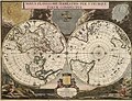
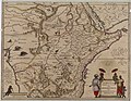
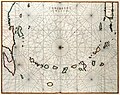
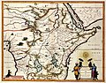
Category:Maps by Willem and Johannes Blaeu
Jump to navigation
Jump to search
Maps by Willem Blaeu and his son Johannes ("Joan"), seventeenth-century Dutch cartographers. Willem Janszoon Blaeu (9 December 1571, Uitgeest or Alkmaar – 21 October 1638, Amsterdam), Joan Blaeu (23 September 1596 – 28 May 1673)
|
| ||||||||||||||||||||||||||||||||||||||||||||||||||||

.jpg)
Subcategories
This category has the following 27 subcategories, out of 27 total.
A
- Archipelagus Orientalis (8 F)
- Asia noviter delineata (37 F)
- Atlas of the Great Elector (9 F)
B
- Blaeu Atlas of Scotland 1654 (53 F)
- Maps of Bruges by Jan Blaeu (4 F)
C
G
- Globus Blaeu (7 F)
I
- Iceland map by Joris Carolus (14 F)
L
M
- Magni Ducatus Lithuaniae (36 F)
N
P
Pages in category "Maps by Willem and Johannes Blaeu"
This category contains only the following page.
Media in category "Maps by Willem and Johannes Blaeu"
The following 200 files are in this category, out of 688 total.
(previous page) (next page)-
 Normandia ducatus (8346434660).jpg 800 × 680; 130 KB
-
 "Asia Noviter Delineata". Amsterdam, Guglielmus Blaeu, 1635.jpg 1,024 × 778; 785 KB
-

-
 "Danubius Fluvius Europae Maximus. Amsterdam, Guglielmus Blaeu, 1640.jpg 3,309 × 1,456; 2.74 MB
-
 "Fifae Pars Occidentalis = The West part of Fife." (22071187850).jpg 3,976 × 3,126; 2.14 MB
-
 "Rhenus Fluviorum Europae Celeberrimus". Amsterdam, Guglielmus Blaeu, 1640.jpg 5,796 × 2,575; 10.68 MB
-
 's Hertogenbosch 1649 Blaeu''.jpg 750 × 562; 214 KB
-
 09 - Marca D'Ancona olim Picenum, 1640 - Willem Janszoon Blaeu.jpg 2,651 × 2,194; 1.5 MB
-
 14. Duinkerken 1635 GMG429 240 Duynkerck 1640 Blaeu.jpg 9,249 × 6,074; 6.92 MB
-
 1606 -26 Nova Blaeu mr.jpg 1,533 × 1,152; 2.36 MB
-
 1608 0 Licht der Zeevaart Blaeu.jpg 1,000 × 938; 492 KB
-
 1612 Wadden Blaeu kaart 22 (20) 43454.jpg 6,714 × 3,063; 8.04 MB
-
 Blaeu Americae Nova Tabula 1614 (1617) UTA.jpg 4,200 × 3,219; 3.49 MB
-
 Blaeu Africae Nova Descriptio 1617 UTA.jpg 6,810 × 5,031; 16.44 MB
-
 1621 Americæ Blaeu.jpg 6,689 × 4,969; 36.6 MB
-
 1627 GMG965 3 Zeespiegel Blaeu cropped.jpg 2,316 × 3,696; 2.38 MB
-
 1627 GMG965 58 Schouwen Blaeu.jpg 4,709 × 3,739; 6.07 MB
-

-
 1631 Index Appendix GMG697 224.jpg 1,811 × 1,024; 561 KB
-

-
 1635 Alexandria detail map Africa by Blaeu 3805125.png 721 × 533; 896 KB
-
 1635 Alger detail map Africa by Blaeu 3805125.png 711 × 531; 890 KB
-
 1635 Blaeu - Carte du Bourdelois.jpg 590 × 995; 177 KB
-
 1635 Indice Theatre I & II GMG170.jpg 2,543 × 1,008; 928 KB
-
 1635 Le Theatre du Monde ou Nouvel Atlas world map by Willem and Johannes Blaeu 1889.jpg 4,632 × 3,064; 6.09 MB
-

-
 1635 Tripoli detail map Africa by Blaeu 3805125.png 1,254 × 666; 1.99 MB
-
 1635 Tunis detail map Africa by Blaeu 3805125.png 718 × 537; 863 KB
-
 1635 Tunis detail map Africa by Willem Blaeu 3805125.png 1,254 × 666; 1.99 MB
-

-
 Lotharingia Ducatus, vulgo Lorraine - btv1b53152723j (2 of 4).jpg 5,933 × 4,629; 7.23 MB
-
 1640 CIRCVLVS WESTPHALICUS Blaeu.jpg 2,500 × 1,937; 4.5 MB
-
 1641 Ieper + Blaeu HR.JPG 5,500 × 4,479; 2.78 MB
-
 1644 Europa Recens Blaeu Black Sea.jpg 1,550 × 1,077; 1.83 MB
-
 1644 Europa Recens Blaeu cropped.jpg 1,502 × 2,449; 3.07 MB
-
 1644 Europa Recens Blaeu East Mediterranean Sea.jpg 1,427 × 1,277; 2.03 MB
-
 1644 Europa Recens Blaeu.jpg 7,427 × 5,632; 23.14 MB
-
 1645 81 Stonehenge Blaeu NESA01 L04-0081 X+.jpg 3,272 × 2,835; 2.62 MB
-
 1646 map of Asia by Blaeu published by Scolari.jpg 27,000 × 19,422; 159.63 MB
-
 1649 Toonneel Blaeu.jpg 990 × 1,526; 223 KB
-
 1651 Toonneel .. 's Konings Blaeu.jpg 750 × 1,269; 223 KB
-
 1651 Toonneel Blaeu.jpg 728 × 1,180; 268 KB
-
 1652 Theatrum Urbium Belgicae Blaeu.jpg 1,518 × 2,438; 379 KB
-
 1659 Europæ Nova Descriptio Blaeu.jpg 3,125 × 2,375; 5.05 MB
-
 1662 - Blaeu - Guienne & Gascogne.jpeg 1,277 × 966; 676 KB
-
 1662 Samogetia is Lithuania.jpg 2,908 × 1,772; 1.85 MB
-
 1664 Svecia+ Blaeu HR.JPG 5,500 × 4,416; 2.95 MB
-
 1672 95 Novus Planiglobii Valck'.jpg 8,500 × 6,487; 17.74 MB
-
 1789 - Neueste Karte Von Der Moldau, Walachei, Bessarabien Und Der Krim.jpg 6,022 × 5,550; 10.81 MB
-
 17ct map with current borders of Belarus.jpg 3,968 × 3,363; 4.43 MB
-
 17th Century Map of Teviotdale, Roxburghshire, Scotland.png 568 × 454; 502 KB
-
 20101208105459!Willem Blaeu - Nova totius terrarum orbis geographica ac hydrographica tabula.jpg 6,569 × 4,936; 14.52 MB
-
 22. Geldria Zutfania Blaeu HR.JPG 5,500 × 4,263; 2.92 MB
-
 43411 blaeu-1612-kaart-04.jpg 6,638 × 3,050; 3.67 MB
-
 9 Morea pars 1630.JPG 1,691 × 1,908; 1.76 MB
-
 A bit more to the north and west* From William Blaeu's famous map, 1638.jpg 1,120 × 840; 190 KB
-
 A Chart of Magellan by the Route of Tierra del Fuego WDL3973.png 1,343 × 1,024; 2.99 MB
-
 Aalst.jpg 750 × 613; 234 KB
-
 Aanloop van Texel, RP-P-OB-101.989.jpg 4,200 × 6,140; 3.83 MB
-
 Aardenburg 1649 Blaeu.jpg 1,024 × 694; 139 KB
-
-
 Aethiopia inferior, vel exterior - btv1b531968386 (2 of 3).jpg 5,952 × 4,596; 5.54 MB
-

-

-
 Africa 1635, Willem Janszoon Blaeu (3805125-sheet1-recto).jpg 7,151 × 5,850; 11.85 MB
-
 Africa 1635, Willem Janszoon Blaeu (3805125-sheet2-recto).jpg 7,192 × 5,853; 6.71 MB
-
 Africa 1635, Willem Janszoon Blaeu (3805125-sheet2-verso).jpg 7,178 × 5,876; 6.81 MB
-
 Africa map from Atlas 1648.png 1,716 × 1,288; 1.61 MB
-
 Africae nova descriptio - Auct. Guilielmo Blaeuw - btv1b8468536j (1 of 2).jpg 9,478 × 7,764; 12.06 MB
-
 Africae nova descriptio - Auct. Guilielmo Blaeuw - btv1b8468537z (1 of 2).jpg 7,642 × 6,576; 8.21 MB
-
 Africae nova descripto - Auct. Guiljelmo Blaeuw - btv1b53196877d (2 of 5).jpg 8,699 × 6,396; 10.92 MB
-
 Africæ nova descriptio. LOC 77694182.jpg 4,284 × 3,176; 2.64 MB
-
 Africæ nova descriptio. LOC 77694182.tif 4,284 × 3,176; 38.93 MB
-
 AGAD Guilielmo Blaeuw Europa.png 7,342 × 5,596; 79.02 MB
-
 Alemannia Suevia Superior Christoph Hurter.jpg 2,964 × 2,334; 4.54 MB
-

-
 Americae nova tabula - Auct Guilielmo Blaeurs - btv1b8469704k.jpg 9,490 × 7,860; 12.16 MB
-
 Americae nova tabula - Auct Guilielmo Blaeurs - btv1b84699545.jpg 9,538 × 7,524; 12.64 MB
-
 Americae nova tabula - Auct. Guiljelmo Blaeuw - btv1b53196846q (2 of 5).jpg 8,736 × 6,413; 11.01 MB
-
 Americae nova tabula - auct. Guiljelmo Blaeuw - btv1b85958448 (1 of 2).jpg 9,525 × 7,882; 14.09 MB
-
 Americae nova Tabula - Map of North and South America (Willem Blaeu, 1665).jpg 5,500 × 4,104; 3.63 MB
-
 Blaeu 1652 - Amersfoort.jpg 2,218 × 1,813; 1.29 MB
-
 AMH-7750-KB Map of the Le Maire Strait between Vuurland and Statenland.jpg 2,400 × 1,858; 990 KB
-
 AMH-7753-KB Map of the minor Antilles.jpg 2,400 × 1,903; 1.08 MB
-
 AMH-7762-KB Map of a part of Africa.jpg 2,400 × 1,878; 1.05 MB
-
 América do Sul - Fragmento do Mapa do Mundo de Joan Blaeu (1664).jpg 1,356 × 1,292; 1.33 MB
-
 Anam 1668 Joan Blaeu 05007.jpg 4,912 × 3,264; 4.6 MB
-
 Anglia Regnum - btv1b532254677 (2 of 3).jpg 5,758 × 4,619; 5.6 MB
-
 Antwerpen 1649 Blaeu.jpg 750 × 595; 270 KB
-
 Antwerpen Domus Hansæ.jpg 750 × 576; 164 KB
-
 Aragonia et Navarra.jpg 675 × 519; 118 KB
-
 Aragonia Regnum.jpg 2,824 × 2,268; 5.47 MB
-
 Archiepiscopatus Trevirensis (8341846259).jpg 800 × 645; 129 KB
-
 Armentieres 1649 Blaeu.jpg 1,590 × 1,301; 509 KB
-
 Arroe by Blaeu 1665 (cropped).jpg 3,745 × 2,404; 5.73 MB
-
 Artesia comitatus - btv1b532115886 (3 of 4).jpg 11,225 × 8,520; 15.65 MB
-

-
 Asia novita delineata - Auctore Guilielmo Blaeuw - btv1b8468662c (1 of 2).jpg 9,492 × 7,843; 12.24 MB
-
 Asia noviter delineata - auctore Guiljelmo Blaeuw - btv1b531967826 (2 of 3).jpg 8,715 × 6,586; 10.95 MB
-
 Asia noviter delineata - auctore Guiljelmo Blaeuw - btv1b8592750q (1 of 2).jpg 9,008 × 6,716; 12.61 MB
-
 Atlas Beudeker-C9E10 102 24J-EMMERYCK.jpeg 5,500 × 4,160; 4.69 MB
-
 Atlas Blau - Nothern West Siberia.jpg 454 × 342; 70 KB
-
 Atlas de Wit 1698-pl037-Zierikzee-KB PPN 145205088.jpg 2,000 × 1,670; 1.7 MB
-

-

-
 Axel 1649 Blaeu.jpg 1,024 × 812; 97 KB
-
 B26055918C - Asia noviter delineata.jpg 6,464 × 4,872; 12.73 MB
-
 Barbary Coast on 1644 Europa Recens by Blaeu (cropped).jpg 4,123 × 987; 3.79 MB
-
 Bartholomeuskerk en weeshuis in Schoonhoven kaart Blaeu 1649.jpg 897 × 598; 181 KB
-
 Beauplan Poland XVII map.jpg 6,674 × 5,244; 25.99 MB
-

-
 Bijlmermeer 1626.jpg 1,015 × 779; 222 KB
-
 Wereld van Blaue.jpg 500 × 381; 53 KB
-
 Blaeu - Atlas of Scotland 1654 - ABERDONIA & BANFIA - Aberdeenshire and Banffshire.jpg 6,566 × 5,075; 7.44 MB
-
 Blaeu - Atlas of Scotland 1654 - LOTHIAN AND LINLITQVO - The Lothians Had.jpg 2,991 × 1,209; 2.4 MB
-
 Blaeu - Moluccae Insulae Celeberrimae.jpg 1,400 × 1,072; 390 KB
-
 Blaeu - Nova Belgica et Anglia Nova (Detail Hudson Area).png 798 × 465; 685 KB
-
 Blaeu - Nova Belgica et Anglia Nova.png 5,976 × 4,472; 39.75 MB
-
 Blaeu - siege of 's-Hertogenbosch 1629.PNG 4,165 × 3,264; 23.11 MB
-
 Blaeu - siege of 's-Hertogenbosch trenches 1629.PNG 4,311 × 3,234; 22.61 MB
-
 Blaeu 1635 - Flandriæ Teutonicæ pars orientalior Ausschnitt1.png 968 × 784; 3.71 MB
-
 Blaeu 1649 - Gallia Le Royaume de France.jpg 6,036 × 4,608; 7.23 MB
-
 Blaeu 1652 - 's Gravenhage.jpg 2,039 × 1,565; 747 KB
-
 Blaeu 1652 - 's Hertogenbosch.jpg 2,434 × 1,966; 660 KB
-
 Blaeu 1652 - Alkmaar.jpg 2,484 × 1,966; 971 KB
-
 Blaeu 1652 - Arnhem.jpg 2,330 × 1,966; 942 KB
-
 Blaeu 1652 - Bergen op Zoom.jpg 2,420 × 1,977; 572 KB
-
 Blaeu 1652 - Breda.jpg 2,472 × 1,932; 815 KB
-
 Blaeu 1652 - Delft.jpg 2,434 × 1,886; 891 KB
-
 Blaeu 1652 - Deventer.jpg 2,420 × 1,943; 846 KB
-
 Blaeu 1652 - Dokkum.jpg 1,656 × 1,311; 656 KB
-
 Blaeu 1652 - Dordrecht.jpg 2,446 × 1,989; 605 KB
-
 Blaeu 1652 - Enkhuizen.jpg 2,434 × 1,863; 904 KB
-
 Blaeu 1652 - Gorkum.jpg 2,434 × 1,828; 592 KB
-
 Blaeu 1652 - Gouda.jpg 2,434 × 1,874; 968 KB
-
 Blaeu 1652 - Groningen (2).jpg 2,000 × 1,654; 3 MB
-
 Blaeu 1652 - Groningen (3).jpg 6,232 × 4,978; 15.14 MB
-
 Blaeu 1652 - Groningen - Kanepijpen en Kranepoort.jpg 1,219 × 928; 349 KB
-
 Blaeu 1652 - Groningen.jpg 2,368 × 1,909; 1.06 MB
-
 Blaeu 1652 - Haarlem.jpg 2,446 × 2,012; 995 KB
-
 Blaeu 1652 - Harderwijk.jpg 2,382 × 1,839; 917 KB
-
 Blaeu 1652 - Kampen.jpg 2,458 × 1,989; 913 KB
-
 Blaeu 1652 - Leeuwarden.jpg 1,630 × 1,311; 736 KB
-
 Blaeu 1652 - Leiden.jpg 2,446 × 1,920; 961 KB
-
 Blaeu 1652 - Middelburg.jpg 2,446 × 2,001; 614 KB
-
 Blaeu 1652 - Nymegen.jpg 2,420 × 1,851; 831 KB
-
 Blaeu 1652 - Roermond.jpg 2,446 × 1,943; 620 KB
-
 Blaeu 1652 - Rotterdam.jpg 1,980 × 1,570; 842 KB
-
 Blaeu 1652 - Schoonhoven.jpg 2,440 × 2,016; 1.5 MB
-
 Blaeu 1652 - Sneek.jpg 2,408 × 1,851; 1.34 MB
-
 Blaeu 1652 - Veere.jpg 2,472 × 1,908; 493 KB
-
 Blaeu 1652 - Zwolle.jpg 2,368 × 1,955; 998 KB
-
 Blaeu Erkelens.jpg 761 × 533; 66 KB
-
 Blaeu Herenpoort.jpg 400 × 349; 56 KB
-
 Blaeu Nova Totius Terrarum orbis Geographica ac Hydrographica Tabula 1635.jpg 4,500 × 3,508; 24.13 MB
-
 Blaeu Rees.jpg 750 × 612; 79 KB
-
 Blaeu Toonneel1.jpg 728 × 1,180; 253 KB
-
 Blaeu Toonneel2.jpg 750 × 1,269; 220 KB
-
 Blaeu Vlaardingen 1649.jpg 1,990 × 1,335; 979 KB
-
 Blaeu Zijlpoort.jpg 421 × 354; 62 KB
-
 Blaeu's 10e Blav XVII Span & Afro 1667 Impressum.jpg 3,743 × 6,072; 1.76 MB
-
 Venice arsenale 2 1724.JPG 2,639 × 1,678; 1.38 MB
-
 Blaeu.arctic1638.jpg 2,170 × 1,732; 4.5 MB
-
 Blaeu1640.jpg 1,500 × 1,260; 377 KB
-
 BlaeuGouda.jpg 5,500 × 4,299; 4.06 MB
-
 Blaeus europakart, 1635 (12083845443).jpg 4,500 × 3,585; 21.97 MB
-
 Blauw-1- Print 16683kopie.jpg 500 × 387; 2.27 MB
-
 Blokzijl 1649 Blaeu.jpg 1,590 × 1,317; 371 KB
-
 Bolsward + 3 1649 Blaeu.jpg 750 × 574; 249 KB
-
 Bolsward 1649 Blaeu.jpg 1,590 × 1,195; 460 KB
-
 Brazil- of the Noble Class, of Loves, and of Letters... WDL1074 (back).png 1,229 × 1,024; 2.13 MB
-
 Brazil- of the Noble Class, of Loves, and of Letters... WDL1074.jpg 1,221 × 1,024; 268 KB
-
 Breda (Atlas van Loon).jpg 5,500 × 4,470; 3.57 MB
-
 Breda 1624 Blaeu.jpg 993 × 779; 168 KB
-
 Breda 1637 Blaeu.jpg 999 × 754; 181 KB
-
 Brielle 1649 Blaeu hr.jpg 1,590 × 1,226; 446 KB
-
 Brielle 1649 Blaeu HR².JPG 5,500 × 4,334; 2.7 MB
-
 Broekburg 1649 Blaeu.jpg 1,590 × 1,281; 391 KB
-
 BrugseVrije1664 (cropped).jpg 2,762 × 1,515; 1.42 MB
-
 BrugseVrije1664.jpg 5,500 × 4,327; 3.61 MB
-
 Brussel 1649 Blaeu zw.jpg 3,640 × 3,053; 5.61 MB
-
 Brussel 1649 Blaeu.jpg 986 × 841; 184 KB
-
 Ca. 1640 map of Asia Minor by Willem Blaeu.jpg 6,540 × 5,198; 5.89 MB
-
 Ca. 1640 map of the Dnieper River by Willem Janszoon Blaeu.jpg 8,333 × 18,204; 23.84 MB
-
 Ca. 1645 map of Greece by Johannes et Cornelis Blaeu.jpg 13,348 × 10,534; 26.66 MB
-
 Ca. 1695 Dutch sea chart of the Atlantic Ocean.jpg 3,045 × 2,500; 1.48 MB
-
 Cadsant.jpg 4,693 × 3,128; 1.71 MB
-
 Cadzand 1649 Blaeu.jpg 1,024 × 674; 110 KB
-

-

-

-
 Cartografie in Nederland, kaart van het stroomgebied van de Rijn, NG-501-42.jpg 8,766 × 4,496; 6.51 MB
-

-
 Catalonia, Blaeu.jpeg 2,832 × 2,228; 6.1 MB
-
 Civitatis imp Lindaviensis territorivm.jpg 5,500 × 4,384; 2.37 MB
-
 Coevorden 1592 Blaeu.jpg 998 × 788; 113 KB
-
 Comitatus Bentheim et Steinfurt - auctore Ioanne Westenberg... - btv1b84921631.jpg 9,632 × 7,738; 9.89 MB
-
 Crévecoeur 1649 Blaeu.jpg 760 × 500; 53 KB
-
 Culemborg 1649 Blaeu.jpg 750 × 558; 243 KB
-
 Cusco con S.jpg 2,560 × 1,920; 2.2 MB
.jpg)


.jpg)


_43454.jpg)
_UTA.jpg)


_-_Geographicus_-_BritanniaeHiberniae-blaeu-1631.jpg)


_and_Surrounding_Countries_by_Dutch_%E8%8D%B7%E8%98%AD%E4%BA%BA%E6%89%80%E7%B9%AA%E7%A6%8F%E7%88%BE%E6%91%A9%E6%B2%99%E8%87%BA%E7%81%A3.jpeg)


.jpg)


.jpg)
.jpg)
_-_btv1b85956079_(1_of_2).jpg)
.jpg)
.jpg)
.jpg)
.jpg)

.jpg)
.jpg)
.jpg)


.jpg)


.jpg)
.jpg)
.jpg)


.jpg)

.jpg)


.jpg)

.jpg)
.jpg)

.jpg)
.jpg)
.jpg)


,_BI-B-FM-013C-4.jpg)


.png)


.jpg)
.jpg)


.jpg)


.png)

.jpg)


.jpg)


_-_btv1b8592978g_(1_of_2).jpg)


.jpg)