Category:École-mairie de Mathenay
Jump to navigation
Jump to search
| Object location | | View all coordinates using: OpenStreetMap |
|---|
|
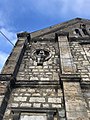
This building is inscrit au titre des monuments historiques de la France. It is indexed in the base Mérimée, a database of architectural heritage maintained by the French Ministry of Culture, under the reference PA39000075
|
_le_6_janvier_2018_-_3.JPG) | |||||
| Upload media | |||||
| Instance of | |||||
|---|---|---|---|---|---|
| Location | Mathenay, Jura, Bourgogne-Franche-Comté, Metropolitan France, France | ||||
| Street address |
| ||||
| Owned by | |||||
| Operator | |||||
| Heritage designation |
| ||||
 | |||||
Media in category "École-mairie de Mathenay"
The following 12 files are in this category, out of 12 total.
-
 Mathenay (Jura, France) le 6 janvier 2018 - 1.JPG 4,032 × 3,024; 3.95 MB
-
 Mathenay (Jura, France) le 6 janvier 2018 - 12.JPG 4,032 × 3,024; 4.22 MB
-
 Mathenay (Jura, France) le 6 janvier 2018 - 3.JPG 4,032 × 3,024; 4.52 MB
-
 Mathenay (Jura, France) le 6 janvier 2018 - 4.JPG 3,024 × 4,032; 5.73 MB
-
 Mathenay (Jura, France) le 6 janvier 2018 - 5.JPG 3,024 × 4,032; 4.73 MB
-
 Mathenay (Jura, France) le 6 janvier 2018 - 6.JPG 3,024 × 4,032; 4.08 MB
-
 Mathenay (Jura, France) le 6 janvier 2018 - 7.JPG 4,032 × 3,024; 6.18 MB
-
 Mathenay (Jura, France) le 6 janvier 2018 - 8.JPG 3,024 × 4,032; 2.72 MB
-
 Mathenay - Défibrillateur.jpg 3,016 × 4,032; 5.32 MB
-
 Mathenay - Entrée mairie.jpg 3,016 × 4,032; 5.8 MB
-
 Mathenay - Entrée salle du conseil mairie.jpg 3,016 × 4,032; 2.22 MB
-
 Mathenay - Mairie-école (façade est).jpg 4,032 × 3,016; 3.54 MB
_le_6_janvier_2018_-_1.JPG)
_le_6_janvier_2018_-_12.JPG)
_le_6_janvier_2018_-_4.JPG)
_le_6_janvier_2018_-_5.JPG)
_le_6_janvier_2018_-_6.JPG)
_le_6_janvier_2018_-_7.JPG)
_le_6_janvier_2018_-_8.JPG)


.jpg)