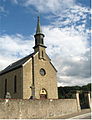
Category:Église Saint-Joseph (Ernster)
Jump to navigation
Jump to search
| Object location | | View all coordinates using: OpenStreetMap |
|---|
 | |||||
| Upload media | |||||
| Instance of | |||||
|---|---|---|---|---|---|
| Location |
| ||||
 | |||||
Media in category "Église Saint-Joseph (Ernster)"
The following 4 files are in this category, out of 4 total.
-
 KieIer14.JPG 2,118 × 2,773; 461 KB
-
 Kirche Ernster 01.jpg 1,431 × 1,950; 1.54 MB
-
 Kirche Ernster 02.jpg 1,963 × 1,425; 1.58 MB
-
 Kirche Ernster 03.jpg 1,403 × 1,995; 1.98 MB


