Category:Église Saint-Willibrord (Hellange)
Jump to navigation
Jump to search
| Object location | | View all coordinates using: OpenStreetMap |
|---|
church in Luxembourg  | |||||
| Upload media | |||||
| Instance of | |||||
|---|---|---|---|---|---|
| Named after | |||||
| Location |
| ||||
 | |||||
Media in category "Église Saint-Willibrord (Hellange)"
The following 4 files are in this category, out of 4 total.
-
 Hellange04.jpg 2,012 × 3,002; 435 KB
-
 Kierch Helleng, Innenansicht.jpg 1,879 × 1,350; 1.24 MB
-
 Kierch Helleng, Strassenseite.jpg 1,854 × 1,400; 1.27 MB
-
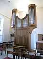 Kierch Helleng, Uergel.jpg 1,400 × 1,880; 1.34 MB


