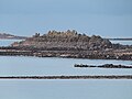
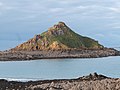
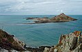
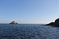
Category:Îlot du Verdelet
Jump to navigation
Jump to search
| Object location | | View all coordinates using: OpenStreetMap |
|---|
island in Côtes-d'Armor, France  | |||||
| Upload media | |||||
| Instance of | |||||
|---|---|---|---|---|---|
| Location | Pléneuf-Val-André, Côtes-d'Armor, Brittany, Q88521114, Metropolitan France, France | ||||
| Located in or next to body of water | |||||
 | |||||
Media in category "Îlot du Verdelet"
The following 27 files are in this category, out of 27 total.
-
 22370 Pléneuf-Val-André, France - panoramio.jpg 1,500 × 1,004; 388 KB
-
 L'îlot du Verdelet (détail).jpg 4,000 × 3,000; 4.36 MB
-
 L'îlot du Verdelet vu depuis la Pointe de Pléneuf.jpg 4,000 × 3,000; 4.96 MB
-
 L'îlot du Verdelet.jpg 4,000 × 3,000; 4.61 MB
-
 Le Val André & le Verdelet.JPG 432 × 324; 11 KB
-
 Le Verdelet depuis le sentier des Douaniers (GR 34) - panoramio.jpg 1,440 × 929; 1.13 MB
-
 Ouverture du corps de garde.jpg 3,000 × 4,000; 4 MB
-
 Plage Granville Roc Verd et au fond l'îlot du Verdelet.jpg 2,918 × 1,940; 2.55 MB
-
 Pléneuf-Val-André - Plage des Vallées - Vue vers la pointe 04.jpg 4,272 × 2,848; 4.08 MB
-
 Pléneuf-Val-André - Îlot du Verdelet (tempête 2023) 01.jpg 4,272 × 2,848; 3.28 MB
-
 Pléneuf-Val-André - Îlot du Verdelet (tempête 2023) 02.jpg 4,272 × 2,848; 3.18 MB
-
 Pléneuf-Val-André - Îlot du Verdelet (tempête 2023) 03.jpg 4,272 × 2,848; 3.33 MB
-
 Pléneuf-Val-André - Îlot du Verdelet 01.jpg 4,272 × 2,848; 4.38 MB
-
 Pléneuf-Val-André - Îlot du Verdelet 02.jpg 4,272 × 2,848; 4.28 MB
-
 Pléneuf-Val-André - Îlot du Verdelet 03.jpg 4,272 × 2,848; 4.05 MB
-
 Pléneuf-Val-André - Îlot du Verdelet 04.jpg 4,272 × 2,848; 3.95 MB
-
 Pléneuf-Val-André - Îlot du Verdelet 05.jpg 4,272 × 2,848; 3.48 MB
-
 Pléneuf-Val-André - Îlot du Verdelet 06.jpg 4,272 × 2,848; 3.8 MB
-
 Pléneuf-Val-André - Îlot du Verdelet 07.jpg 4,272 × 2,848; 5.1 MB
-
 Pléneuf-Val-André - Îlot du Verdelet 08.jpg 4,272 × 2,848; 4.62 MB
-
 Pléneuf-Val-André - Îlot du Verdelet 09.jpg 4,272 × 2,848; 4.78 MB
-
 Pléneuf-Val-André - Îlot du Verdelet 10.jpg 4,272 × 2,848; 4.75 MB
-
 Pléneuf-Val-André - Îlot du Verdelet 11.jpg 4,272 × 2,848; 3.57 MB
-
 Pléneuf-Val-André - Îlot du Verdelet.jpg 4,272 × 2,848; 5.13 MB
-
 Verdelet 2 - panoramio.jpg 1,080 × 1,440; 1.13 MB
-
 Verdelet.jpg 800 × 533; 123 KB
-
 Vue sur l'îlot du Verdelet.jpg 4,000 × 3,000; 4.74 MB

.jpg)


_-_panoramio.jpg)


_01.jpg)
_02.jpg)
_03.jpg)


