Category:Ölme kyrka
Jump to navigation
Jump to search
| Object location | | View all coordinates using: OpenStreetMap |
|---|
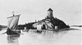
Svenska: Ölme kyrka, tillhör Ölme församling, Kristinehamns pastorat, Östra Värmlands kontrakt, Karlstads stift / Diocese of Karlstad.
|
This is a category about an ecclesiastical monument in Sweden, number 21300000004259 (sub-number: 21420000043520) in the RAÄ buildings database.
|
Church of Sweden church building in Ölme, Sweden  Ölme Church | |||||
| Upload media | |||||
| Instance of | |||||
|---|---|---|---|---|---|
| Location | Kristinehamn Municipality, Värmland County, Sweden | ||||
| Diocese | |||||
| Connects with |
| ||||
| Has use |
| ||||
| Occupant |
| ||||
| Heritage designation |
| ||||
| Inception |
| ||||
 | |||||
Media in category "Ölme kyrka"
The following 32 files are in this category, out of 32 total.
-
 Ölme kyrka - KMB - 16000200148796.jpg 948 × 600; 92 KB
-
 Ölme kyrka - KMB - 16000200148797.jpg 803 × 600; 93 KB
-
 Ölme kyrka - KMB - 16000200148798.jpg 871 × 600; 68 KB
-
 Ölme kyrka - KMB - 16000200148799.jpg 1,004 × 600; 104 KB
-
 Ölme kyrka - KMB - 16000200148801.jpg 594 × 600; 75 KB
-
 Ölme kyrka - KMB - 16000200148803.jpg 406 × 600; 42 KB
-
 Ölme kyrka - KMB - 16000200148806.jpg 1,022 × 600; 91 KB
-
 Ölme kyrka - KMB - 16000200148807.jpg 1,014 × 600; 97 KB
-
 Ölme kyrka - KMB - 16000200148808.jpg 1,019 × 600; 67 KB
-
 Ölme kyrka - KMB - 16000200148809.jpg 422 × 600; 63 KB
-
 Ölme kyrka - KMB - 16000200148810.jpg 428 × 600; 36 KB
-
 Ölme kyrka - KMB - 16000200148811.jpg 411 × 600; 41 KB
-
 Ölme kyrka - KMB - 16000200148812.jpg 427 × 600; 46 KB
-
 Ölme kyrka - KMB - 16000200148813.jpg 355 × 600; 38 KB
-
 Ölme kyrka - KMB - 16000200148814.jpg 394 × 600; 64 KB
-
 Ölme kyrka - KMB - 16000200148815.jpg 447 × 600; 68 KB
-
 Ölme kyrka - KMB - 16000200148817.jpg 421 × 600; 62 KB
-
 Ölme kyrka - KMB - 16000200148818.jpg 849 × 600; 117 KB
-
 Ölme kyrka - KMB - 16000200148819.jpg 933 × 600; 93 KB
-
 Ölme kyrka - KMB - 16000200148822.jpg 740 × 600; 77 KB
-
 Ölme kyrka - KMB - 16000200148823.jpg 443 × 600; 44 KB
-
 Ölme kyrka - KMB - 16000200148832.jpg 410 × 600; 42 KB
-
 Ölme kyrka - KMB - 16000200148833.jpg 417 × 600; 44 KB
-
 Ölme kyrka - KMB - 16000200148835.jpg 422 × 600; 54 KB
-
 Ölme kyrka - KMB - 16000200148836.jpg 420 × 600; 46 KB
-
 Ölme kyrka - KMB - 16000200148837.jpg 597 × 600; 79 KB
-
 Ölme kyrka - KMB - 16000200148842.jpg 1,091 × 600; 70 KB
-
 Ölme kyrka 1.JPG 1,632 × 1,224; 316 KB
-
 Ölme kyrka 2.jpg 1,388 × 1,050; 317 KB
-
 Ölme kyrka 3.JPG 1,632 × 1,224; 191 KB
-
 Ölme kyrka 4.JPG 1,632 × 1,224; 205 KB
-
 Ölme kyrka1.JPG 640 × 480; 96 KB


Categories:
- Built in Kristinehamn Municipality in 1788
- Churches in the Diocese of Karlstad
- Churches in Kristinehamn Municipality
- Churches in Värmland
- Churches in Sweden built in 1788
- Listed churches in Kristinehamn Municipality
- Neoclassical churches in Värmland County
- Stone churches in Värmland County
- White churches in Sweden
- 1780s churches in Värmland County
- Mansards in Sweden
- Aisleless churches in Sweden