Category:Úhorná Pass
Jump to navigation
Jump to search
| Object location | | View all coordinates using: OpenStreetMap |
|---|
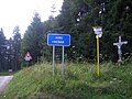
Úhorná Pass (sk: Úhornianské sedlo, hu: Pacsai-hágó) is a mountain pass (altitude 999 m) between the municipalities of Pača and Úhorná. The pass is located along route II/549.
Media in category "Úhorná Pass"
The following 5 files are in this category, out of 5 total.
-
 Úhorná01.JPG 1,600 × 1,200; 200 KB
-
 Úhorná02.JPG 1,600 × 1,200; 535 KB
-
 Úhorná03.JPG 1,600 × 1,200; 399 KB
-
 Úhorná04.JPG 1,200 × 1,600; 360 KB
-
 Úhorná05.JPG 1,600 × 1,200; 449 KB


