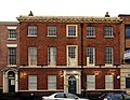
Category:116 Duke Street, Liverpool
Jump to navigation
Jump to search
| Object location | | View all coordinates using: OpenStreetMap |
|---|
building in Liverpool, Merseyside, UK  | |||||
| Upload media | |||||
| Instance of | |||||
|---|---|---|---|---|---|
| Location | Liverpool, Merseyside, North West England, England | ||||
| Street address |
| ||||
| Heritage designation |
| ||||
 | |||||
Media in category "116 Duke Street, Liverpool"
The following 3 files are in this category, out of 3 total.
-
 116 Duke Street 201808.jpg 4,361 × 3,323; 8.67 MB
-
 116 Duke Street, Liverpool 2018.jpg 4,167 × 3,227; 6.91 MB
-
 116 Duke Street, Liverpool.jpg 5,152 × 3,864; 7.64 MB

