Category:11 Kościelna Street in Sławków
Jump to navigation
Jump to search
| Object location | | View all coordinates using: OpenStreetMap |
|---|
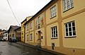
Polski: Budynek dawnego szpitala górniczego - Sławków, ul. Kościelna 11
building in Sławków, Silesian Voivodeship, Poland  | |||||
| Upload media | |||||
| Instance of | |||||
|---|---|---|---|---|---|
| Location | Sławków, Będzin County, Silesian Voivodeship, Poland | ||||
| Street address |
| ||||
| Heritage designation |
| ||||
| Inception |
| ||||
 | |||||
Media in category "11 Kościelna Street in Sławków"
The following 8 files are in this category, out of 8 total.
-
 Budynek dawnego szpitala górniczego w Sławkowie 01.JPG 3,456 × 2,592; 3.14 MB
-
 Budynek dawnego szpitala górniczego w Sławkowie 02.JPG 3,456 × 2,592; 3.03 MB
-
 Budynek szpitala gorniczego w Slawkowie.jpg 2,560 × 1,920; 1.15 MB
-
 Dom z XVIII wieku, późnobarokowy, przebudowany w XIX wieku i w 1959 roku.jpg 3,901 × 2,544; 4.84 MB
-
 Slawkow Koscielna 11 Swietoslaw & St Stanislaw 2018.jpg 3,001 × 2,000; 3.44 MB
-
 Slawkow Zaluski plaque.jpg 1,448 × 1,108; 1.05 MB
-
 Szpital gorn Slawkow 07 2016.jpg 3,264 × 1,836; 1.56 MB
-
 Sławków, ulica Kościelna, Caritas.jpg 2,791 × 1,815; 996 KB


