Category:1320s maps of Spain
Jump to navigation
Jump to search
Media in category "1320s maps of Spain"
The following 10 files are in this category, out of 10 total.
-

-

-
 Península Ibérica no mapa-múndi de Paulinus Venetus (c. 1320).jpg 528 × 476; 138 KB
-

-
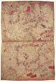
 1325 Portolan chart of Angellino de Dalorto - 3.tif 9,732 × 6,675; 185.88 MB
-
 Atlantic map from Pietro Vesconte 1321 atlas.jpg 1,007 × 1,478; 533 KB
-
 Atlantic map from Pietro Vesconte 1325 atlas.jpg 1,954 × 2,848; 2.65 MB
-
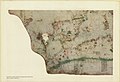
 Dalorto 1325 map (partial).jpg 1,600 × 949; 563 KB
-
 Península Ibérica no portolano de Angelino Dalorto ou Dulceto (1325 ou 1330).jpg 1,896 × 1,343; 2.06 MB
-
 The portolan chart of Angellino de Dalorto, 1325 (nla.obj-233481158).jpg 5,000 × 3,429; 9.95 MB
_Norte_Peninsula_Iberica.jpg)
.jpg)
.jpg)
.jpg)


.jpg)
.jpg)
.jpg)