Category:13th-century maps of the Mediterranean Sea
Jump to navigation
Jump to search
Media in category "13th-century maps of the Mediterranean Sea"
The following 8 files are in this category, out of 8 total.
-
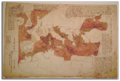
 1290-CARTA-PISANA300-dpi.jpg 2,691 × 1,356; 3.01 MB
-
 Carte Pisane Portolan.jpg 3,481 × 1,848; 2.15 MB
-
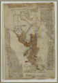
 Mapa do Mediterráneo do Libro de Curiosidades (1190-1210).jpg 12,599 × 8,560; 14.32 MB
-
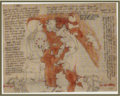
 Opicinus de Canistris world map, 1296 – 1300.png 815 × 552; 771 KB
-
 Opicinus de Canistris World Map, 1296-1300.jpg 7,169 × 4,176; 6.42 MB
-
-
-


.jpg)


