Help
Category
:
1540s maps of Egypt
From Wikimedia Commons, the free media repository
Jump to navigation
Jump to search
Countries of Africa
:
Egypt
‡
·
Libya
‡
:
partly located in Africa
16th-century maps of Egypt
:
1510s
1520s
1530s
1540s
1550s
1560s
1570s
1580s
1590s
→
Media in category "1540s maps of Egypt"
The following 3 files are in this category, out of 3 total.
Europe and northern Africa. HM 29. PORTOLAN ATLAS, anonymous (Dieppe, 1547).L.jpg
878 × 695; 220 KB
Geographia by Ptolemy, Aphricae Tabula IIII, 1540 Basel edition - Maps of Africa - Robert C. Williams Paper Museum - DSC00631.JPG
4,957 × 3,620; 4.88 MB
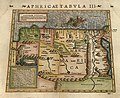
Münster Aphricae Tabula III 1540 UTA.jpg
4,384 × 3,587; 6.94 MB
Categories
:
16th-century maps of Egypt
1540s maps of the Ottoman Empire
1540s maps of Africa
1540s maps of Asia
Egypt in the 1540s
1540s maps by country
Navigation menu
Personal tools
English
Not logged in
Talk
Contributions
Create account
Log in
Namespaces
Category
Discussion
English
Views
View
Edit
History
More
Search
Navigate
Main page
Welcome
Community portal
Village pump
Help center
Participate
Upload file
Recent changes
Latest files
Random file
Contact us
Tools
What links here
Related changes
Special pages
Permanent link
Page information
Get shortened URL
Download QR code
Print/export
Create a book
Download as PDF
Printable version
In Wikipedia
Add links