Category:1542 maps
Jump to navigation
Jump to search
| ← · 1540 · 1541 · 1542 · 1543 · 1544 · 1545 · 1546 · 1547 · 1548 · 1549 · → |
Deutsch: Karten mit Bezug zum Jahr 1542
English: Maps related to the year 1542
Español: Mapas relativos al año 1542
Français : Cartes concernant l’an 1542
Русский: Карты 1542 года
Subcategories
This category has the following 4 subcategories, out of 4 total.
Media in category "1542 maps"
The following 14 files are in this category, out of 14 total.
-
 GRAVIER(1896) p101 Carte de Henri II - 1542.jpg 1,887 × 2,656; 2.49 MB
-

-
 CANADA MAP 1542 HARLEYENNE.jpg 2,366 × 1,690; 1.23 MB
-
 India Extrema XIX Nova Tabula.jpg 500 × 400; 56 KB
-
 L'Amérique centr(ale) LOC 2004626118.jpg 5,553 × 4,092; 2.44 MB
-
 L'Amérique centr(ale) LOC 2004626118.tif 5,553 × 4,092; 65.01 MB
-
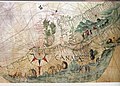
 Oceano Atlántico no Boke of Idrography de Jean Rotz (1542).jpg 8,668 × 6,712; 22.54 MB
-
 Perpignan - Siège de 1473-75.jpg 4,953 × 4,248; 2.01 MB
-
 Ptolemy, Aphricae Tabula II (FL13726101 2496563).jpg 6,282 × 5,094; 47.63 MB
-
 Ptolemy, Tabula Asiae XII (FL27950684 2474003).jpg 9,126 × 7,251; 89.99 MB
-
 Ptolemy, Terra Sancta XVI nova tabula (FL6882322 2368936).jpg 3,163 × 2,132; 2.87 MB
-
 Tabula Asia VIII 00798. Typus Universalis 00681 - no-nb krt 00798.jpg 7,781 × 5,788; 9.07 MB
-
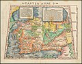 Tabula Asiae I (1542).jpg 1,732 × 1,350; 684 KB
-
 Tabula Asiae VI.jpg 1,620 × 1,300; 2.6 MB
_p101_Carte_de_Henri_II_-_1542.jpg)


_LOC_2004626118.jpg)
.jpg)

.jpg)
.jpg)
.jpg)

.jpg)
