Category:1550s maps of Asia
Jump to navigation
Jump to search
Temperate regions: North America · South America · Africa · Europe · Asia · – Polar regions: – Other regions:
Subcategories
This category has the following 16 subcategories, out of 16 total.
- 1550 maps of Asia (1 F)
- 1552 maps of Asia (2 F)
- 1553 maps of Asia (empty)
- 1554 maps of Asia (2 F)
.
C
E
- 1550s maps of Egypt (3 F)
I
- 1550s maps of Iran (2 F)
P
- 1550s maps of Pakistan (empty)
- 1550s maps of Palestine (2 F)
R
T
- 1550s maps of Turkey (7 F)
Media in category "1550s maps of Asia"
The following 5 files are in this category, out of 5 total.
-
 Red Sea and Persian Gulf RMG F1768.tiff 5,183 × 7,000; 103.8 MB
-
 Atlas nautique portugais - btv1b53074825v (07 of 16).jpg 13,227 × 9,794; 16.06 MB
-
 Diego Homem - Africa.jpg 8,738 × 12,079; 30.24 MB
-
 Persia RMG F1728.tiff 7,381 × 4,799; 101.34 MB
-
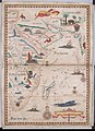
 Tavola della oriental region dell' Asia, che comprende l'estreme terre, & regni di quella.jpg 9,182 × 7,187; 15.59 MB
.jpg)

