Category:1558 maps of Europe
Jump to navigation
Jump to search
English: 1558 maps of Europe
Español: Mapas de Europa en 1558
Suomi: Euroopan kartat vuodelta 1558
Română: Hărți ale Europei din 1558
Subcategories
This category has the following 2 subcategories, out of 2 total.
F
- 1558 maps of France (1 F)
N
- 1558 maps of the Netherlands (1 F)
Media in category "1558 maps of Europe"
The following 5 files are in this category, out of 5 total.
-
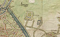 1558 Map of Bruges by Jacob van Deventer (detail).jpg 846 × 522; 209 KB
-
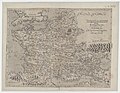
 Houghton 51-2529 - Totius Galliae descriptio, 1558.jpg 2,389 × 1,800; 1.99 MB
-

-

-
.jpg)


._Sebastianus_a_Regibus_Clodiensis_incidebat_-_btv1b8492890b.jpg)