Category:1590s maps of Belgium
Jump to navigation
Jump to search
Countries of Europe: Albania · Armenia‡ · Austria · Belgium · Bosnia and Herzegovina · Bulgaria · Croatia · Cyprus‡ · Denmark · Estonia · Finland · France‡ · Georgia‡ · Germany · Greece · Hungary · Iceland · Republic of Ireland · Italy · Lithuania · Netherlands‡ · Norway · Poland · Portugal‡ · Romania · Russia‡ · Spain‡ · Sweden · Turkey‡ · Ukraine
‡: partly located in Europe
‡: partly located in Europe
Media in category "1590s maps of Belgium"
The following 6 files are in this category, out of 6 total.
-

-

-
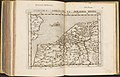
 1593 Germania Inferior de Jode.jpg 750 × 595; 280 KB
-
 Hannoniae Comitatus Descriptio - btv1b55004837g.jpg 6,780 × 5,316; 4.46 MB
-
-
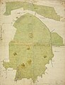 Miradal.jpg 2,116 × 2,755; 1.04 MB
.jpg)


_36.jpg)
