Category:1610s maps of Iceland
Jump to navigation
Jump to search
Countries of Europe: Armenia‡ · Azerbaijan‡ · Belarus · Belgium · Cyprus‡ · Denmark · Finland · France‡ · Georgia‡ · Germany · Greece · Iceland · Republic of Ireland · Italy · Lithuania · Netherlands‡ · Norway · Poland · Portugal‡ · Romania · Russia‡ · Spain‡ · Sweden · Switzerland · Turkey‡ · Ukraine
‡: partly located in Europe
‡: partly located in Europe
Media in category "1610s maps of Iceland"
The following 2 files are in this category, out of 2 total.
-
 Barents third voyage.jpg 2,000 × 1,511; 965 KB
-
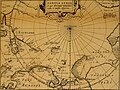 Pontanus 1611 Arctic Map.jpg 2,852 × 2,142; 802 KB

