Category:1630s maps of Turkey
Jump to navigation
Jump to search
Countries of Europe: Armenia‡ · Belgium · Cyprus‡ · Denmark · France‡ · Georgia‡ · Germany · Greece · Republic of Ireland · Italy · Lithuania · Netherlands‡ · Norway · Portugal‡ · Russia‡ · Spain‡ · Sweden · Switzerland · Turkey‡ · Ukraine
‡: partly located in Europe
‡: partly located in Europe
Media in category "1630s maps of Turkey"
The following 3 files are in this category, out of 3 total.
-
 Gelibolu - Taboas geraes de toda a navegação LOC 78653638-21 (cropped).tif 1,968 × 1,726; 9.72 MB
-
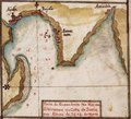 Gulf of Iskenderun - Taboas geraes de toda a navegação LOC 78653638-21 (cropped).tif 1,960 × 1,773; 9.94 MB
-
 Sea of Marmara - Taboas geraes de toda a navegação LOC 78653638-21 (cropped).tif 3,896 × 1,694; 18.88 MB