Category:1660s maps of Lithuania
Jump to navigation
Jump to search
Countries of Europe: Azerbaijan‡ · Belgium · Bulgaria · Croatia · Denmark · France‡ · Germany · Greece · Hungary · Republic of Ireland · Italy · Lithuania · Netherlands‡ · Norway · Poland · Portugal‡ · Romania · Russia‡ · Serbia · Spain‡ · Switzerland · Turkey‡ · Ukraine
‡: partly located in Europe
‡: partly located in Europe
Subcategories
This category has the following 2 subcategories, out of 2 total.
Media in category "1660s maps of Lithuania"
The following 7 files are in this category, out of 7 total.
-
 Vialikaje Kniastva Litoŭskaje. Вялікае Княства Літоўскае (P. Kaerius, 1661).jpg 4,607 × 3,089; 5.26 MB
-
 1662 Samogetia is Lithuania.jpg 2,908 × 1,772; 1.85 MB
-
 Atlas Van der Hagen-KW1049B10 029-LIVONIA Vulgo Lyetland.jpeg 5,500 × 4,318; 3.12 MB
-

-

-

-
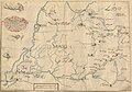 Kurlandyja-Žamojć. Курляндыя-Жамойць (1667).jpg 5,232 × 3,649; 2.67 MB
.jpg)


.2.(22).jpg)
.2.(24).jpg)
.jpg)