Category:1680s maps of Mexico
Jump to navigation
Jump to search
Media in category "1680s maps of Mexico"
The following 10 files are in this category, out of 10 total.
-
 New Spain; Guiana (NYPL b14428893-1503455).jpg 2,243 × 3,828; 2.2 MB
-
 Map of Mexico and Central America, 1685.jpg 599 × 900; 405 KB
-
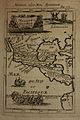
 Map of Mexico.jpg 450 × 670; 76 KB
-
 Provincia de S. Diego de Mexico en la Nueva España... - btv1b8443124v.jpg 5,711 × 4,390; 3.37 MB
-
 Ratkaj map1.jpg 400 × 290; 30 KB
-

-

-

-
 Cartes generales de toutes les parties du monde 1681 (127473261).jpg 13,983 × 9,444; 17.72 MB
-
 Tillemon & Coronelli Nouveau Mexique 1687 UTA.jpg 2,908 × 2,244; 6.4 MB
.jpg)


_and_Mexico_City_view_(reverse)%27_(1683-1687)_by_Pedro_Villegas_(attr.)_-_Museo_Soumaya_-_Mexico_2024_(2).jpg)
_and_Mexico_City_view_(reverse)%27_(1683-1687)_by_Pedro_Villegas_(attr.)_-_Museo_Soumaya_-_Mexico_2024_(3).jpg)
_and_Mexico_City_view_(reverse)%27_(1683-1687)_by_Pedro_Villegas_(attr.)_-_Museo_Soumaya_-_Mexico_2024.jpg)
.jpg)
