Category:1690s maps of Hungary
Jump to navigation
Jump to search
Countries of Europe: Armenia‡ · Austria · Azerbaijan‡ · Belarus · Belgium · Bulgaria · Croatia · Cyprus‡ · Denmark · France‡ · Georgia‡ · Germany · Greece · Hungary · Republic of Ireland · Italy · Lithuania · Montenegro · Netherlands‡ · Norway · Poland · Portugal‡ · Russia‡ · Spain‡ · Sweden · Switzerland · Turkey‡ · Ukraine
‡: partly located in Europe
‡: partly located in Europe
Media in category "1690s maps of Hungary"
The following 2 files are in this category, out of 2 total.
-
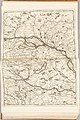 Atlante Veneto Volume 1 150.jpg 6,543 × 9,808; 8.48 MB
-
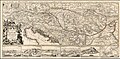 1693 Map - Le Cours du Danube Depuis sa Source jusqu'a ses Embouchures.jpg 9,774 × 4,773; 12.45 MB

