Category:1698 maps
Jump to navigation
Jump to search
| ← · 1690 · 1691 · 1692 · 1693 · 1694 · 1695 · 1696 · 1697 · 1698 · 1699 · → |
Deutsch: Karten mit Bezug zum Jahr 1698
English: Maps related to the year 1698
Español: Mapas relativos al año 1698
Français : Cartes concernant l’an 1698
Русский: Карты 1698 года
Subcategories
This category has the following 4 subcategories, out of 4 total.
Media in category "1698 maps"
The following 60 files are in this category, out of 60 total.
-
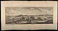
 A. Constantinopolen, b. Galata, c. Pera (FL33122178 2369932).jpg 24,526 × 7,964; 276.11 MB
-

-

-
 Beauley river RMG F1781.tiff 4,759 × 7,485; 101.91 MB
-
-

-
 BNE.Barcelona.planos.1698.jpg 3,284 × 1,231; 2.1 MB
-
 Bussleton river RMG F1780.tiff 4,825 × 7,482; 103.28 MB
-
 Carte evesche Jalliot-1698.png 880 × 807; 1.63 MB
-
 Carte Faremoutiers-Jalliot1698.png 649 × 433; 684 KB
-
 Carte Presidial-Nolin-1698.png 878 × 601; 1.17 MB
-
 Christ Church River westward of Hurst Castle within the Isle of Wight RMG F1783.tiff 4,733 × 7,496; 101.51 MB
-
 Cornelis de Bruijn, Alexandria (FL33122208 2370043).jpg 15,787 × 6,016; 143.84 MB
-
 Cornelis de Bruijn, Bethlehem (FL6880556 2370347).jpg 3,408 × 1,850; 2.58 MB
-
 Cornelis de Bruijn, Famagusta (FL79963579 2566303).jpg 9,428 × 3,969; 46.64 MB
-
 Cornelis de Bruijn, Ierusalem (FL6878276 2367971).jpg 4,800 × 1,209; 3.62 MB
-
 Cornelis de Bruijn, Ioppe (FL6878864 2370346).jpg 2,722 × 2,280; 1.88 MB
-
 Cornelis de Bruijn, Palmyra alias Tadmor (FL33127528 2370126).jpg 15,775 × 7,195; 166.16 MB
-
 Cornelis de Bruijn, Rama (FL6879092 2369557).jpg 3,986 × 1,550; 4.78 MB
-
 Cornelis de Bruijn, Rhodus (FL35076749 2565241).jpg 15,698 × 6,076; 135.89 MB
-
 Cornelis de Bruijn, Rhodus (FL35076776 2565239).jpg 15,947 × 6,256; 140.37 MB
-
 Cornelis de Bruijn, Scanderona (FL79963567 2566300).jpg 9,452 × 3,755; 44.41 MB
-
 Cornelis de Bruijn, Scutari; Serragio di Constantinopoli (FL167448483 2369939).jpg 24,473 × 7,894; 292.61 MB
-
 Cornelis de Bruijn, Smyrna (FL168327157 2369940).jpg 23,958 × 7,797; 248.08 MB
-
 Cornelis de Bruijn, Tiberias (FL163876624 2476917).jpg 6,845 × 5,720; 30.53 MB
-
 Cornelis de Bruijn, Tripolis (FL33122124 2369953).jpg 10,156 × 7,496; 106.87 MB
-
 Cornelis de Bruijn, Tyrus (FL33122162 2369956).jpg 15,832 × 6,456; 156.91 MB
-
 Diocese de Nismes (5121154344).jpg 2,000 × 1,428; 2.84 MB
-

-
 Lymington River east of Hurst Castle within the Isle of Wight RMG F1782.tiff 4,746 × 7,496; 101.78 MB
-
 Map - Special Collections University of Amsterdam - OTM- HB-KZL 33.22.62.tif 7,374 × 6,135; 129.43 MB
-
 Plan de Longwy 1698 (cropped).jpg 3,145 × 2,357; 1.29 MB
-
 Plan de Longwy 1698.jpg 7,376 × 5,133; 5.52 MB
-
 Plan Nienshanz i Neva 1698.jpg 1,566 × 1,600; 1.13 MB
-

-
 The harbour of Dartmouth RMG F1787.tiff 4,721 × 7,496; 101.25 MB
-
 The harbour of Falmouth RMG F1789.tiff 4,759 × 7,448; 101.41 MB
-
 The harbour of Fowey RMG F1788.tiff 4,733 × 7,496; 101.51 MB
-
 The haven and town of Poole near the Isle of Purbeck RMG F1784.tiff 4,721 × 7,460; 100.76 MB
-
 The haven of Cookmere and levells between the hills RMG F1776.tiff 4,831 × 7,418; 102.53 MB
-
 The haven of Pemsey and levell about adjacent to ye town RMG F1775.tiff 4,755 × 7,462; 101.51 MB
-
 The port of Rye at low water RMG F1774.tiff 4,736 × 7,537; 102.13 MB
-
 The port of Weymouth and Melcomb Regis and part of the bay of Portland RMG F1785.tiff 4,709 × 7,460; 100.51 MB
-
 The river of Arundell and levell about ye same RMG F1779.tiff 4,782 × 7,532; 103.05 MB
-
 The river of Exmouth RMG F1786.tiff 4,734 × 7,460; 101.04 MB
-
 The river of New-Haven and levell between ye hills RMG F1777.tiff 4,771 × 7,448; 101.66 MB
-
 The river of Shoreham and levell above between ye hills RMG F1778.tiff 4,745 × 7,508; 101.93 MB
-

-

-

-

-
-

-
 UBBasel Map 1698 Kartenslg Schw A 119.tif 15,290 × 10,850, 2 pages; 474.66 MB
-
 UBBasel Map 1698 Kartenslg Schw A 120.tif 13,651 × 9,163, 2 pages; 357.89 MB
-
 UBBasel Map 1698 Kartenslg Schw A 121.tif 14,090 × 9,543, 2 pages; 384.72 MB
-
 UBBasel Map 1698 Kartenslg Schw A 122.tif 13,745 × 9,203, 2 pages; 361.93 MB
-
 UBBasel Map 1698 Kartenslg Schw Ca 16.tif 7,327 × 8,710, 2 pages; 182.61 MB
-
 UBBasel Map 1698 Kartenslg Schw Ca 17.tif 6,982 × 8,696, 2 pages; 173.73 MB
-
 Vincenzo Coronelli, ISOLA DI CORFU (FL35069461 2528683).jpg 16,000 × 11,855; 275.72 MB
.jpg)
.jpg)
.jpg)
.jpg)


.jpg)
.jpg)
.jpg)
.jpg)
.jpg)
.jpg)
.jpg)
.jpg)
.jpg)


.jpg)
.jpg)


.jpg)
.jpg)
.jpg)
.jpg)
.jpg)
.jpg)
.jpg)
.jpg)
.jpg)
.jpg)
.jpg)
.jpg)