Category:16th-century maps of Crimea
Jump to navigation
Jump to search
Subcategories
This category has only the following subcategory.
M
Media in category "16th-century maps of Crimea"
The following 13 files are in this category, out of 13 total.
-
-
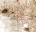
 Battista Agnese. Black Sea. HM 25. PORTOLAN ATLAS Italy, ca. 1540.C.jpg 1,100 × 865; 331 KB
-
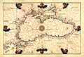
 Battista Agnese map of the Black Sea (A).jpg 3,469 × 2,316; 3.31 MB
-
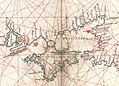
 Battista Agnese. Black Sea. HM 26. PORTOLAN ATLAS Italy, ca. 1544.D.jpg 824 × 939; 314 KB
-
 1544 Battista Agnese map of the Black Sea.jpg 3,757 × 2,537; 4.14 MB
-

-
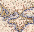
 Map of the Crimaean peninsula - Bordone Benedetto - 1547.jpg 800 × 463; 165 KB
-
 Tabula Asiae II.jpg 1,024 × 816; 233 KB
-
 Battista Agnese. Black Sea. HM 10. PORTOLAN ATLAS Italy, ca. 1550.C.jpg 1,750 × 1,257; 785 KB
-
 Battista Agnese. Black Sea. HM 27. PORTOLAN ATLAS (Venice 1553).C.jpg 1,548 × 1,306; 625 KB
-
-
 Daniel Keller. Asiae nova descriptio (Antwerpen, 1590).LU4.jpg 1,774 × 1,027; 329 KB
-
 Taurica Chersonesus. Nostra aetate Przecopsca et Gazara dicitur.jpg 10,574 × 8,439; 13.68 MB
.C.jpg)

.jpg)


.H.jpg)


.C.jpg)
.D.jpg)
.LU4.jpg)
