Category:16th-century maps of Eastern Europe
Jump to navigation
Jump to search
English: This category is for 16th-century overview maps of Eastern Europe that span more than just one or two specific modern countries. "Eastern Europe" is here used for all areas east of the Holy Roman Empire.
For more detailed maps about specific countries or regions (like Balkans, Wallachia, Transylvania), please check the sub-categories.
For more detailed maps about specific countries or regions (like Balkans, Wallachia, Transylvania), please check the sub-categories.
Subcategories
This category has the following 23 subcategories, out of 23 total.
- 1540s maps of Eastern Europe (10 F)
- 1550s maps of Eastern Europe (11 F)
- 1560s maps of Eastern Europe (6 F)
- 1570s maps of Eastern Europe (10 F)
B
C
E
F
G
H
M
P
R
U
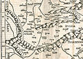
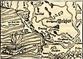
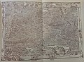
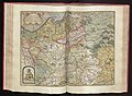
Media in category "16th-century maps of Eastern Europe"
The following 14 files are in this category, out of 14 total.
-
-
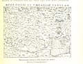
 Московское государство или Белая Русь, 1507 (Marco Beneventano).jpg 1,476 × 1,050; 470 KB
-
 A map of Russia by Battist Agneze, 1525. Text p.3.jpg 760 × 572; 120 KB
-

-
 Print, book-illustration, map (BM 1982,U.2445).jpg 1,600 × 1,203; 546 KB
-
 Print, book-illustration, map (BM 1982,U.2438).jpg 1,594 × 1,123; 479 KB
-
 Print, book-illustration, map (BM 1982,U.2442).jpg 1,591 × 965; 427 KB
-
 Print, book-illustration, map (BM 1982,U.2446).jpg 1,833 × 1,450; 723 KB
-
 Herberstein's Map of Muscovy, 16th c.jpg 3,941 × 2,875; 4.38 MB
-
 Kart425(0239).jpg 4,000 × 2,929; 1.72 MB
-
-
 Cosmographia - Beschreibung aller Lender durch Sebastianum Munsterum (1545) 23.jpg 11,164 × 7,165; 7.02 MB
-
 Cosmographia - Beschreibung aller Lender durch Sebastianum Munsterum (1545) 24.jpg 11,164 × 7,156; 7.46 MB
-
 Cosmographia - Beschreibung aller Lender durch Sebastianum Munsterum (1545) 33.jpg 10,678 × 6,847; 6.59 MB

.jpg)

.jpg)
.jpg)
.jpg)
.jpg)
.jpg)

.jpg)
%27_(11302239363).jpg)
_23.jpg)
_24.jpg)
_33.jpg)