Category:16th-century maps of London
Jump to navigation
Jump to search
Ceremonial counties of England: Bedfordshire · Berkshire · Buckinghamshire · Cambridgeshire · Cheshire · Cornwall · Derbyshire · Devon · Dorset · Durham · Essex · Gloucestershire · Greater London · Hampshire · Herefordshire · Hertfordshire · Isle of Wight · Kent · Lancashire · Leicestershire · Lincolnshire · Norfolk · Northamptonshire · Northumberland · Nottinghamshire · Oxfordshire · Rutland · Shropshire · Somerset · Staffordshire · Suffolk · Surrey · Warwickshire · Wiltshire · Worcestershire
City-counties:
Former historic counties: Cumberland · Huntingdonshire · Middlesex · Sussex · Westmorland · Yorkshire
Other former counties:
City-counties:
Former historic counties: Cumberland · Huntingdonshire · Middlesex · Sussex · Westmorland · Yorkshire
Other former counties:
Subcategories
This category has the following 5 subcategories, out of 5 total.
Media in category "16th-century maps of London"
The following 28 files are in this category, out of 28 total.
-
 10 of 'Old Southwark and its people' (11126087243).jpg 2,034 × 2,908; 933 KB
-
 11 of 'Old Southwark and its people' (11125618236).jpg 2,024 × 2,888; 1.1 MB
-

-
-
-
 34 of 'Old Southwark and its people' (11269554445).jpg 1,807 × 888; 469 KB
-
 35 of 'Old Southwark and its people' (11270670755).jpg 1,807 × 902; 471 KB
-
 Image taken from page 697 of 'Old and New London, etc' (11188749234).jpg 2,848 × 1,996; 1.8 MB
-
 London Described (BM Heal,Topography.185).jpg 2,500 × 1,660; 998 KB
-
 242 of 'Old Southwark and its people' (11075741153).jpg 968 × 805; 199 KB
-

-
 73 of 'Bygone Southwark' (11233074603).jpg 2,144 × 1,115; 513 KB
-

-
 Enfield Park 1593.jpg 352 × 278; 101 KB
-
 Greyfriars-site-map.JPG 2,920 × 1,747; 1.03 MB
-

-
 London theatres C16—C17, Red Lion.jpg 1,600 × 982; 621 KB
-
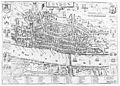 Map of the city of London. Wellcome M0012961.jpg 3,879 × 2,792; 2.89 MB
-
 Map of Westminster. Wellcome M0012962.jpg 4,087 × 2,628; 3.33 MB
-
 Maps Of Old London Wyngaerde Part 1.jpg 2,553 × 1,711; 875 KB
-
 Maps Of Old London Wyngaerde Part 2.jpg 2,629 × 1,643; 933 KB
-
 Maps Of Old London Wyngaerde Part 3.jpg 2,577 × 1,687; 850 KB
-
 Plan of Bankside. Wellcome L0008637.jpg 1,898 × 1,052; 700 KB
-
 Plan of London in the Middle Ages. Wellcome M0003592.jpg 4,007 × 2,781; 5.26 MB
-

-
 The site of Leicester Square, 1560 (?). Wellcome M0003591.jpg 3,756 × 3,026; 4.39 MB
-
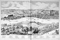
 The Strand in 1560. Wellcome M0003590.jpg 4,146 × 2,744; 3.48 MB
-
 VintyWardAgas1572.jpg 760 × 426; 56 KB
.jpg)
.jpg)
.jpg)
.jpg)
.jpg)
.jpg)
.jpg)
.jpg)
.jpg)
.jpg)
.jpg)
%27_(11127498756).jpg)


.jpg)


_(14581979900).jpg)
._Wellcome_M0003591.jpg)


.jpg)