Category:16th-century maps of Lorraine
Jump to navigation
Jump to search
Administrative regions and territorial collectivity of Metropolitan France (‡ since start of 2016):
Brittany · Corsica
Former administrative regions of Metropolitan France (until end of 2015):
Alsace · Lorraine
Overseas departments and regions: Guadeloupe · Martinique
Brittany · Corsica
Former administrative regions of Metropolitan France (until end of 2015):
Alsace · Lorraine
Overseas departments and regions: Guadeloupe · Martinique
Subcategories
This category has the following 2 subcategories, out of 2 total.
Media in category "16th-century maps of Lorraine"
The following 5 files are in this category, out of 5 total.
-
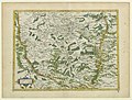
 Lotharingiae typus ortelius 1588.jpg 800 × 575; 68 KB
-
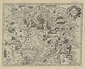
 Lorraine vers le midy ; Lorraine vers le midy - btv1b550049851.jpg 6,929 × 5,252; 3.84 MB
-
 Lorraine vers Septentrion - btv1b550052005.jpg 6,911 × 5,259; 4.16 MB
-
 Lorraine vers Septentrion... Lorraine vers le midy - btv1b53223532f.jpg 5,714 × 4,606; 5.75 MB
-
 Lotharengia Ducatus - btv1b8492997k.jpg 8,048 × 5,836; 8.98 MB


