Category:16th-century maps of New York (state)
Jump to navigation
Jump to search
States of the United States: Alaska · California · Florida · Georgia · Massachusetts · New York · North Carolina · South Carolina · Virginia
Puerto Rico
Puerto Rico
Media in category "16th-century maps of New York (state)"
The following 2 files are in this category, out of 2 total.
-
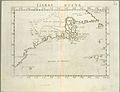 Tierra nveva (NYPL b13868891-484204).jpg 4,776 × 3,646; 3.16 MB
-
 Tierra nveva (NYPL b15307937-434500).tiff 5,251 × 4,256; 63.98 MB
.jpg)