Category:1700s maps of Serbia
Jump to navigation
Jump to search
Countries of Europe: Albania · Armenia‡ · Austria · Azerbaijan‡ · Belgium · Croatia · Denmark · France‡ · Georgia‡ · Germany · Greece · Hungary · Republic of Ireland · Italy · Lithuania · Netherlands‡ · Norway · Portugal‡ · Romania · Russia‡ · Serbia · Slovenia · Spain‡ · Sweden · Switzerland · Turkey‡ · Ukraine
‡: partly located in Europe
‡: partly located in Europe
Media in category "1700s maps of Serbia"
The following 2 files are in this category, out of 2 total.
-
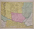 Banat1700.jpg 737 × 623; 157 KB
-
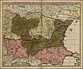 Exactissima Tabula qua tam Danubii Fluvii Pars Inferior.jpg 4,934 × 4,068; 3.89 MB

