Category:1700s maps of Venezuela
Jump to navigation
Jump to search
Media in category "1700s maps of Venezuela"
The following 14 files are in this category, out of 14 total.
-
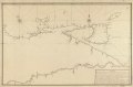 (Map of northeastern coast of Venezuela including Trinidad and Tobago Islands). LOC 90682931.tif 9,427 × 6,238; 168.24 MB
-

-

-

-
 La Guayra. LOC 90682971.jpg 5,024 × 3,693; 2.13 MB
-
 La Guayra. LOC 90682971.tif 5,024 × 3,693; 53.08 MB
-

-

-
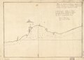
 Plano de la vista del surgidero de Araya. LOC 90682956.jpg 4,507 × 3,245; 1.5 MB
-
 Plano de la vista del surgidero de Araya. LOC 90682956.tif 4,507 × 3,245; 41.84 MB
-

-
-

-


