Category:1700s maps showing history
Jump to navigation
Jump to search
Subcategories
This category has the following 2 subcategories, out of 2 total.
Media in category "1700s maps showing history"
The following 14 files are in this category, out of 14 total.
-

-
-
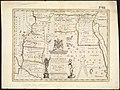
 Canaan, or The Land of promise. LOC 99466735.tif 5,899 × 4,114; 69.43 MB
-
-
 1700 map showing Ancient Armenia.jpg 13,815 × 10,800; 18.31 MB
-

-
 Sicilia Antiqua.jpg 5,313 × 4,511; 4.88 MB
-
 Hispaniae antiquae tabula - authore N. Sanson... - btv1b8446519v.jpg 9,732 × 7,716; 10.42 MB
-
 Guillaume Delisle, Græciæ Pars Septentrionalis (FL35069389 2528386).jpg 16,345 × 12,448; 278.67 MB
-
 Guillaume Delisle, Græciæ pars Septentrionalis (FL35072685 2533510).jpg 17,171 × 12,623; 276.34 MB
-

-
 Canaan, or The Land of promise. LOC 99466735.jpg 5,899 × 4,114; 5.79 MB
-
 Colchis and Iberia, 1706.jpg 700 × 419; 165 KB
-
 Germania Antiqua - Aut. N. Sanson - btv1b532026104 (1 of 2).jpg 6,490 × 4,936; 5.03 MB

.jpg)


.jpg)


.jpg)
.jpg)
.jpg)


.jpg)