Category:1710 maps of Spain
Jump to navigation
Jump to search
Media in category "1710 maps of Spain"
The following 5 files are in this category, out of 5 total.
-
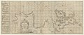 A chart of the sea coasts of England...and part of Barbary - btv1b53009614s.jpg 21,352 × 8,979; 27.58 MB
-
 Carte de la région de Madrid et de Tolède. 1 - 750 000 env - btv1b8493996g.jpg 7,232 × 5,660; 4.96 MB
-
 Les Royaumes de Valence et de Murcie.jpg 6,615 × 8,996; 17.59 MB
-
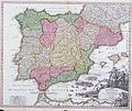 SpainandPortugal1710.jpg 900 × 761; 233 KB
-
 The Harbor and Strait of Gibraltar - Johannes Covens en Cornelis Mortier.jpg 1,276 × 1,076; 777 KB


