Category:1710s maps of Maine
Jump to navigation
Jump to search
States of the United States: Delaware · Florida · Louisiana · Maine · Maryland · Massachusetts · Michigan · New Jersey · New York · North Carolina · Pennsylvania · South Carolina · Virginia
Puerto Rico
Puerto Rico
Media in category "1710s maps of Maine"
This category contains only the following file.
-
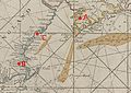 BayOfMaine1713.jpg 2,761 × 1,958; 2.23 MB
