Category:1715 maps of North America
Jump to navigation
Jump to search
Temperate regions: North America · Africa · Europe · Asia · Oceania – Polar regions: – Other regions:
| ← 1710 1711 1712 1713 1715 1717 1718 1719 → |
Media in category "1715 maps of North America"
The following 9 files are in this category, out of 9 total.
-

-
 La Rivière de Missisipi- 1715 - Nicolas de Fer 1646-1720.JPG 1,104 × 794; 123 KB
-

-

-

-
-
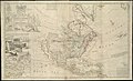
 This map of North America, according to ye newest and most exact observations LOC gm71005445.jpg 11,598 × 7,178; 15.4 MB
-
 This map of North America, according to ye newest and most exact observations LOC gm71005445.tif 11,598 × 7,178; 238.18 MB
-


.jpg)

