Category:1720s maps of Romania
Jump to navigation
Jump to search
Countries of Europe: Albania · Armenia‡ · Azerbaijan‡ · Belgium · Bosnia and Herzegovina · Bulgaria · Croatia · Cyprus‡ · Denmark · France‡ · Georgia‡ · Germany · Greece · Hungary · Republic of Ireland · Italy · Lithuania · Montenegro · Netherlands‡ · Norway · Poland · Portugal‡ · Romania · Russia‡ · Serbia · Slovenia · Spain‡ · Sweden · Switzerland · Turkey‡ · Ukraine · United Kingdom
Limited recognition: Abkhazia‡
‡: partly located in Europe
Limited recognition: Abkhazia‡
‡: partly located in Europe
Media in category "1720s maps of Romania"
The following 6 files are in this category, out of 6 total.
-
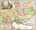
 Map HOMANNO Ukrania.jpg 3,000 × 2,521; 2.44 MB
-

-

-
 Heraldic fragment of Tabula Valachiæ Cis-alutanæ, 1723.png 1,274 × 718; 1.74 MB
-
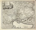
 Herman Moll's map of Turkey in Europe, Romanian areas (1726).png 1,023 × 710; 859 KB
-


.png)
.jpg)