Category:1720s maps of Taiwan
Jump to navigation
Jump to search
Countries of Asia: Armenia‡ · Azerbaijan‡ · People's Republic of China · Cyprus‡ · Egypt‡ · Georgia‡ · India · Indonesia‡ · Iran · Iraq · Japan · Philippines · Russia‡ · Syria · Turkey‡
Limited recognition: Abkhazia‡ · Taiwan · State of Palestine
‡: partly located in Asia
Limited recognition: Abkhazia‡ · Taiwan · State of Palestine
‡: partly located in Asia
Media in category "1720s maps of Taiwan"
The following 10 files are in this category, out of 10 total.
-
 1727 Map of Formosa-Taiwan by the Dutch 荷蘭文福爾摩沙-臺灣地圖.jpg 1,663 × 1,377; 1.61 MB
-
 L'Ile de Formosa 1.jpg 800 × 604; 113 KB
-
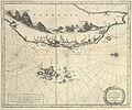 L'Ile de Formosa.jpg 652 × 541; 138 KB
-
 KAART Eyland Formosa.gif 621 × 788; 366 KB
-
 Kaart Van Het Eyland Formosa (small, color).jpg 874 × 704; 207 KB
-
 Kaart van het Eyland Formosa en de Eylanden van Piscadores.jpg 4,522 × 3,644; 11.35 MB
-
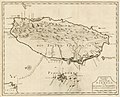
 Kaart van het Eyland Formosa.jpg 2,400 × 1,931; 683 KB
-
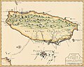
 Old Taiwan map.jpg 1,744 × 1,236; 1,021 KB
-

-
 Dutch-pescadores.png 989 × 656; 684 KB


.jpg)


