Category:1740s maps of Arabia
Jump to navigation
Jump to search
Media in category "1740s maps of Arabia"
The following 9 files are in this category, out of 9 total.
-
 Abu Bakr Ibn Braham. Mappa dell'Impero Ottomanno. composta da Abubekir Efendi. 1740.jpg 6,413 × 5,183; 5.42 MB
-

-
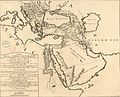
 Safavid Persian Empire.jpg 1,195 × 969; 370 KB
-
 Makran.makoran pars1744 Amesterdam.jpg 1,200 × 948; 323 KB
-

-
 Bellin - Karte von der Küste von Arabien c.1745 (crop).png 789 × 666; 669 KB
-
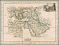
 AMH-7880-KB Map of the Arab peninsula.jpg 2,400 × 2,130; 1,003 KB
-
 1748 map of the Turkish Empire by Georges Louis Le Rouge.jpg 6,887 × 5,267; 6.81 MB
-
 Map of the Coast of Arabia, the Red Sea and the Persian Gulf WDL2918.png 1,158 × 1,024; 2.09 MB


.jpg)
.png)


