Category:1740s maps of Austria
Jump to navigation
Jump to search
Countries of Europe: Albania · Armenia‡ · Austria · Azerbaijan‡ · Belarus · Belgium · Bosnia and Herzegovina · Bulgaria · Croatia · Cyprus‡ · Czech Republic · Denmark · France‡ · Georgia‡ · Germany · Greece · Republic of Ireland · Italy · Lithuania · Netherlands‡ · Norway · Poland · Portugal‡ · Romania · Russia‡ · Serbia · Slovenia · Spain‡ · Sweden · Switzerland · Turkey‡ · Ukraine · United Kingdom
Limited recognition: Abkhazia‡
‡: partly located in Europe
Limited recognition: Abkhazia‡
‡: partly located in Europe
States of Austria:
Media in category "1740s maps of Austria"
The following 5 files are in this category, out of 5 total.
-

-
 Ca. 1740 map of Vienna by Georges Louis Le Rouge.jpg 14,930 × 10,691; 32.78 MB
-
 Map - Special Collections University of Amsterdam - OTM- HB-KZL 32.01.56.tif 7,316 × 6,182; 129.4 MB
-
 Matthias Seutter Bodensee 18 Jh 2.jpg 940 × 820; 818 KB
-
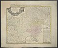 Sacri Romani Imperii Circulus Austriacus.jpg 8,093 × 6,777; 17.8 MB


