Category:1740s maps of England
Jump to navigation
Jump to search
Subcategories
This category has the following 2 subcategories, out of 2 total.
- 1746 maps of England (empty)
L
Media in category "1740s maps of England"
The following 6 files are in this category, out of 6 total.
-
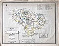
 Figg copy of Kelton 1747 map of Ashdown Forest.jpg 1,020 × 828; 117 KB
-
 William Figg 1858 copy of Kelton 1747 map of Ashdown Forest.jpg 880 × 690; 85 KB
-

-

-
 Print, map (BM 1848,0212.6).jpg 1,696 × 2,500; 1.31 MB
-
 Thamesis Descriptio Anno 1588 (Map of the Thames, 1588) (BM J,11.11).jpg 2,500 × 1,809; 619 KB


.jpg)
_(BM_J,11.11).jpg)