Category:1747 maps of Europe
Jump to navigation
Jump to search
Temperate regions: North America · South America · Africa · Europe · Asia · – Polar regions: – Other regions:
English: 1747 maps of Europe
Español: Mapas de Europa en 1747
Suomi: Euroopan kartat vuodelta 1747
Română: Hărți ale Europei din 1747
Subcategories
This category has the following 16 subcategories, out of 16 total.
'
.
B
- 1747 maps of Belgium (6 F)
C
- 1747 maps of Czechia (1 F)
F
G
I
N
- 1747 maps of the Netherlands (5 F)
- 1747 maps of Norway (3 F)
P
- 1747 maps of Portugal (2 F)
R
- 1747 maps of Russia (3 F)
S
- 1747 maps of Spain (4 F)
- 1747 maps of Sweden (1 F)
T
- 1747 maps of Turkey (2 F)
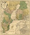
Media in category "1747 maps of Europe"
The following 5 files are in this category, out of 5 total.
-

-

-
 Charta öfver Svea och Göta Riken med Finland och Norland.jpg 5,791 × 6,739; 9.05 MB
-
 Europe map 1747 Bowen.jpg 5,828 × 4,344; 4.35 MB
-
 UBBasel Map 1747 Kartenslg Schw Cm 3 Schaffhauser Gebiet.tiff 10,776 × 7,949, 2 pages; 245.09 MB
_-_Geographicus_-_OldGreenland-bowen-1747.jpg)
_-_Geographicus_-_Austriacus-hmhr-1747.jpg)

