Category:1750s maps of the Balkans
Jump to navigation
Jump to search
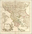
English: This category is intended to collect maps from the 1750s that show multiple Balkan countries in one map frame.
Subcategories
This category has the following 4 subcategories, out of 4 total.
C
- 1750s maps of Croatia (1 F)
G
- 1750s maps of Greece (6 F)
R
- 1750s maps of Romania (empty)
S
- 1750s maps of Serbia (2 F)
Media in category "1750s maps of the Balkans"
The following 8 files are in this category, out of 8 total.
-
Balkans-Vaugondy-Robert 1752.jpg 4,000 × 4,224; 4.78 MB
-
Graecia Vetus Map of Ancient Greece.jpg 3,425 × 3,009; 9.28 MB
-
1755 map of Turkey in Europe.jpg 11,953 × 12,702; 19.27 MB


